Area Overview for Elstow
Photos of Elstow
Area Information
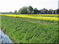
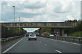
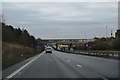
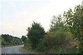
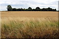
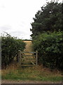
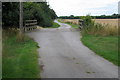
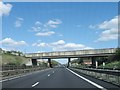
Living in Elstow means calling a civil parish in the Borough of Bedford your home. This area spans approximately 6.0 square kilometres and sits about 3.2 km south of the town centre. You will find yourself inside the southern bypass, yet still enjoying the sense of a distinct community. Elstow retains a tranquil village green surrounded by a conservation area featuring buildings that date back from the 13th to the 17th century. These historic structures stand in contrast to the 20th-century housing that now surrounds the original village core. The location offers easy access to the main road connecting Bedford to London. The village green and the Church of St Mary and St Helen anchor the daily rhythm of life here. You can walk to the Moot Hall, a timber-framed building from the 1440s that now serves as a museum and music venue. John Bunyan, the author of *The Pilgrim's Progress*, was born in a cottage in this parish that still stands today. The area feels like an oasis of calm despite its proximity to expanding suburbs. Historic ties to the Benedictine nunnery founded in 1078 by Countess Judith add a layer of depth to the local character. The postcode district MK42 places you within the wider Bedford network while offering a slower pace.
- Area Type
- Parish
- Area Size
- 6.0 km²
- Population
- Not available
- Population Density
- Not available
Demographics
The community in Elstow is overwhelmingly mature, with a median age of 70 years. Most residents fall into the older age brackets typical of a retirement or semi-retirement village. Home ownership is the dominant housing tenure, reaching a level of 70% across the parish. This high rate of ownership suggests stability and long-term roots within the community. You will encounter a population that values established neighbourhoods over transient living situations. The household composition reflects this demographic reality, with families likely consisting of seniors or couples rather than young professionals. There is no specific data provided regarding predominant ethnic groups or religious affiliations in the current records, but the demographic profile strongly points toward a settled, older populace. The absence of significant youth populations shapes the social environment and local services. Deprivation indicators are not detailed in the available information, yet the high ownership rate often correlates with wealthier or more stable local economics. Life here revolves around a demographic that has likely lived in these same streets for decades. The village green and conservation area cater specifically to this age profile, offering peaceful spaces rather than vibrant youth hubs.
Household Size
Accommodation Type
Tenure
Ethnic Group
Religion
Household Composition
Age
Household Deprivation
NS-SEC
Explore more demographic insights in this area
Go to Demographics tabPlanning
Planning Constraints
- Flood RiskPremium
- Ramsar Wetland SitesPremium
- Area of Outstanding Natural BeautyPremium
- Protected Nature ReservePremium
- Protected WoodlandPremium
- Crime RiskPremium