Area Overview for Eastwood Park Ward
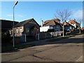
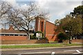
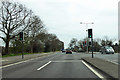
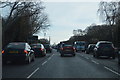
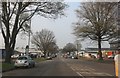
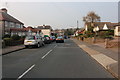
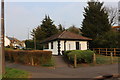
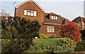
Photos of Eastwood Park Ward
Area Information
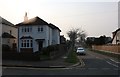
Eastwood Park Ward is a compact district covering just 2.2 km² within the unitary borough of Nottingham. It functions as a defined neighbourhood where residents enjoy a small-scale environment. The area is characterised by a high degree of residential stability, reflected in the fact that 83 per cent of households own their property. This figure distinguishes the ward from many parts of the country where renting is more common. Living in Eastwood Park Ward means engaging with a community where long-term ownership is the norm. The ward sits on the boundary between Eastwood South Park and Mansfield Boundary Park, forming part of the larger Eastwood area. You will find homes near Eastwood Park Ward that cater to established families and older residents. The median age of 70 tells a specific story about who calls this place home. Many people here are settled and have strong ties to the local neighbourhood. Daily life revolves around familiar streets and a quiet pace that suits those seeking retirement downsizing or a peaceful retirement home. The estate agency hyperbole of "stunning" locations does not apply here; instead, the value lies in its stability and defined boundaries.
- Area Type
- District Borough Unitary Ward
- Area Size
- 2.2 km²
- Population
- Not available
- Population Density
- Not available
Demographics
Your understanding of the community in Eastwood Park Ward starts with the age profile. The median age of 70 indicates that the population is significantly older than the national average. While the dataset lists the most common age range simply as "total", the median clearly demonstrates that the ward has a mature demographic. You are looking at an area where residents are likely nearing or in retirement. Eighty-three per cent of the population owns their homes, a figure that is exceptionally high compared to broader market trends. This level of home ownership suggests a resident base that is deeply embedded in the local geography. It implies that many people in Eastwood Park Ward chose to stay rather than move away. The lack of specific data on ethnic composition or religious demographics prevents assumptions about diversity, but the high ownership rate often correlates with long-standing community institutions. When evaluating homes in Eastwood Park Ward, expect a neighbourhood where neighbours have lived there for decades. The household composition data is not explicitly broken down, but the age and ownership figures paint a picture of a settled, owner-occupied environment. This context is vital for anyone considering buying into this specific ward.
Household Size
Accommodation Type
Tenure
Ethnic Group
Religion
Household Composition
Age
Household Deprivation
NS-SEC
Explore more demographic insights in this area
Go to Demographics tabPlanning
Planning Constraints
- Flood RiskPremium
- Ramsar Wetland SitesPremium
- Area of Outstanding Natural BeautyPremium
- Protected Nature ReservePremium
- Protected WoodlandPremium
- Crime RiskPremium