Area Overview for East Wretham
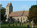
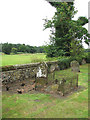
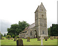
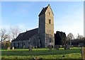
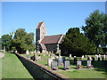
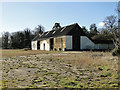
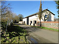
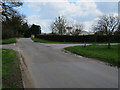
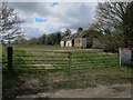
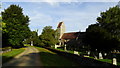
Photos of East Wretham


Area Information
East Wretham is a compact built-up area spanning 25.1 hectares, nestled in England. It is a place where older residents form the core of the community, with a median age of 70, suggesting a settled, long-term population. The area’s proximity to Thetford and its two railway stations—Harling Road and Thetford—offers convenient access to nearby towns and services. Daily life here is shaped by a mix of local retail, including Tesco Thetford and Aldi East, which provide essential shopping options. While the area’s size is modest, its infrastructure supports practical living, with a low crime risk score of 87, reflecting a safer environment. East Wretham is not a place for those seeking a fast-paced urban lifestyle but suits those prioritising stability, security, and proximity to essential amenities. Its character is defined by a quiet, community-focused rhythm, where the presence of home ownership—77% of households—are rooted in long-term residency. For buyers, it offers a straightforward, no-frills option in a region where practicality and safety are prioritised over novelty.
- Area Type
- Built Up Area 250
- Area Size
- 25.1 hectares
- Population
- Not available
- Population Density
- Not available
Residents of East Wretham have access to essential amenities within practical reach. The area’s two railway stations—Harling Road and Thetford—provide direct connections to larger towns, facilitating commuting or leisure travel. For retail, Tesco Thetford, M&S Icknield Way BP, and Aldi East offer a range of shopping options, from groceries to everyday essentials. While there is no mention of parks or leisure facilities in the data, the presence of local supermarkets and transport links ensures daily needs are met efficiently. The area’s character is defined by its simplicity, with amenities focused on practicality rather than luxury. For those who prioritise convenience and connectivity, East Wretham’s proximity to these services supports a low-effort lifestyle. The absence of cultural or recreational hubs may appeal to those seeking a quiet, functional environment over a vibrant, amenity-rich one.
Amenities
Schools
| Rank | School | Type | Entry gender | Ages |
|---|
Explore more schools in this area
Go to Schools tabDemographics
The demographic profile of East Wretham is marked by an older population, with a median age of 70. This suggests a community where retirement is the predominant life stage, though specific data on household composition or accommodation types is not available. Home ownership is high, with 77% of households owning their properties, indicating a stable, long-term resident base. The data does not specify ethnic diversity or religious composition, but the absence of detailed breakdowns means these factors remain unquantified. The area’s age profile likely influences its social dynamics, with fewer young families or transient populations. For quality of life, the high home ownership rate and low crime risk contribute to a predictable, secure environment. However, the lack of data on deprivation or diversity means broader contextual analysis is limited. Residents here appear to value stability over change, with a housing stock that reflects decades of consistent occupancy.
Household Size
Accommodation Type
Tenure
Ethnic Group
Religion
Household Composition
Age
Household Deprivation
NS-SEC
Explore more demographic insights in this area
Go to Demographics tabPlanning
Planning Constraints
- Crime RiskPremium