Area Overview for East Hanningfield
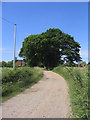
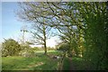
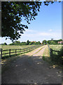
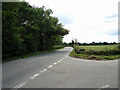
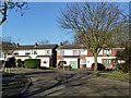
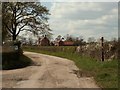
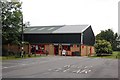
Photos of East Hanningfield


Area Information
East Hanningfield is a compact built-up area in England, spanning 45.2 hectares. It is home to a population predominantly in the older age bracket, with a median age of 70, suggesting a community shaped by long-term residents. The area’s size and demographics indicate a quiet, stable neighbourhood where most homes are owner-occupied, reflecting a sense of permanence. Daily life here is likely characterised by a slower pace, with local amenities and transport links providing practical convenience. While the area is small, it is served by multiple railway stations, including South Woodham Ferrers and Battlesbridge, offering easy access to nearby towns. The presence of a primary school with a good Ofsted rating adds to its appeal for families. East Hanningfield’s blend of modest housing stock, reliable transport, and low crime risk makes it a viable option for those seeking a settled, low-maintenance lifestyle.
- Area Type
- Built Up Area 250
- Area Size
- 45.2 hectares
- Population
- Not available
- Population Density
- Not available
East Hanningfield’s lifestyle is supported by nearby amenities, including five retail outlets such as M&S South Woodam Ferrers BP and Sainsburys South, ensuring access to shopping and daily essentials. The proximity to three railway stations and a bus stop enhances mobility, allowing residents to reach larger towns or cities easily. While specific parks or leisure facilities are not detailed in the data, the availability of retail and transport options suggests a practical, convenience-focused lifestyle. The area’s mix of shops, transport links, and community-focused schools creates a functional environment for daily living, though further local exploration would be needed to assess recreational or green space opportunities.
Amenities
Schools
The nearest school to East Hanningfield is the East Hanningfield Church of England Primary School, which serves the local community with a good Ofsted rating. This primary school is a key asset for families, offering a reliable education for younger children. The absence of secondary schools in the immediate vicinity may require families to consider commuting to nearby towns for further education, but the primary school’s quality ensures a strong foundation for early learning. The school’s presence also contributes to the area’s appeal, as it provides a focal point for community interaction. For parents prioritising local schooling, this primary institution is a significant advantage, though additional research would be needed to assess secondary education options.
| Rank | School | Type | Entry gender | Ages |
|---|
Explore more schools in this area
Go to Schools tabDemographics
East Hanningfield’s population is defined by its median age of 70, with the most common age range encompassing all demographics. This suggests a community where older residents form a significant proportion, possibly due to long-standing residency or limited recent development. Home ownership is high, with 79% of households owning their homes, indicating a stable, owner-occupied market. The accommodation types and household compositions are not specified in detail, but the data implies a mix of traditional housing. The area’s demographic profile suggests a low turnover of residents, fostering a sense of continuity. However, the lack of specific figures on diversity or deprivation means the community’s full character remains opaque. For those considering relocation, the high home ownership rate and older population may align with preferences for established, low-risk environments.
Household Size
Accommodation Type
Tenure
Ethnic Group
Religion
Household Composition
Age
Household Deprivation
NS-SEC
Explore more demographic insights in this area
Go to Demographics tabPlanning
Planning Constraints
- Crime RiskPremium