Area Overview for Durrants Ward
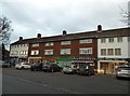
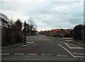
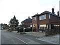
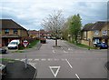
Photos of Durrants Ward

Area Information
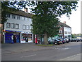
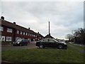
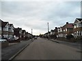
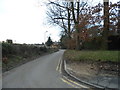
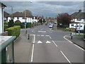
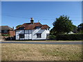
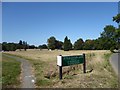
Durrants Ward is a small electoral ward within the London Borough of Enfield, covering an area of just 1.4 km². You will find the location situated near Hertford Road, which historically served as the route known as the kings highe way leading to London from 1610. The area centres around Durants Park, a public open space created in 1903 from the former estate of the Durrants manor house. This green space acts as a defining feature for residents, offering a local pocket of nature amidst the built environment. Nearby hamlets recorded as Cocksmiths End in 1572 and 1658 contribute to the local heritage, while the surviving gatehouse from the original manor serves as a physical link to the past. Most transport access comes via London Buses routes 121, 191, 279, and 307 that operate along the main artery of Hertford Road. These services connect you to Enfield Wash, Ponders End, and Brimsdown. Living in Durrants Ward means relying on these bus links as there are no specific railway stations immediately identified for the ward. The district sits at coordinates near 51.65375119467699, -0.4402374229994972, placing it firmly within north London. Daily life here focuses on a quiet residential setting with strong historical roots and convenient bus connectivity for those working in surrounding boroughs.
- Area Type
- District Borough Unitary Ward
- Area Size
- 1.4 km²
- Population
- Not available
- Population Density
- Not available
Demographics
The community in Durrants Ward has a distinctly mature character, with a median age of 70 years. This demographic profile indicates that the area is best suited for retirees or those who prefer a quieter lifestyle away from high-density urban centres. Home ownership stands at an impressive 88%, a figure that signals a stable neighbourhood where the vast majority of residents have a long-term stake in their local community. Such high ownership levels often correlate with lower tenant turnover and a stronger sense of place among inhabitants. While the most common age range covers the total population, the data confirms that older adults form the core of the demographic structure. This concentration of older residents shapes the local economy and culture, likely favouring quieter streets and community services tailored to senior needs. Accommodation types follow the general ward trends without skewed data, suggesting a housing stock aligned with the preferences of long-term owners. There are no recorded Ramsar wetland sites, Areas of Outstanding Natural Beauty, protected nature reserves, or protected woodland within the boundaries. This absence of major planning constraints simplifies local development potential, though the 1.4 km² size limits large-scale expansion. The high home ownership rate combined with the age profile paints a picture of a settled, low-volatility community where residents have deep roots and minimal intention to relocate short-term.
Household Size
Accommodation Type
Tenure
Ethnic Group
Religion
Household Composition
Age
Household Deprivation
NS-SEC
Explore more demographic insights in this area
Go to Demographics tabPlanning
Planning Constraints
- Flood RiskPremium
- Ramsar Wetland SitesPremium
- Area of Outstanding Natural BeautyPremium
- Protected Nature ReservePremium
- Protected WoodlandPremium
- Crime RiskPremium