Area Overview for Dunton
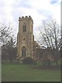
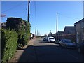
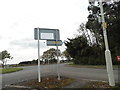
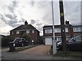
Photos of Dunton


Area Information
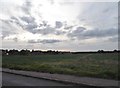
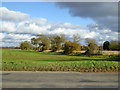
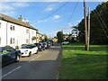
Dunton is a built-up area in England, covering 21.1 hectares. It is a small, compact community with a distinct character shaped by its mature population. The area is home to a mix of housing types, with 72% of residents owning their homes. This suggests a stable, long-term resident base, many of whom may have lived in the area for decades. Daily life in Dunton is likely quiet and low-key, with a focus on local amenities and nearby towns. The proximity to Biggleswade and Sandy, both within practical reach, means residents have access to larger retail, transport, and leisure options without needing to travel far. The area’s small size and older demographic suggest a tight-knit community, though it lacks the density of a larger town. For those seeking a peaceful, established neighbourhood with easy access to nearby services, Dunton offers a straightforward, unpretentious lifestyle. Its appeal lies in its simplicity: no skyscrapers, no overcrowding, just a well-defined local identity with clear boundaries.
- Area Type
- Built Up Area 250
- Area Size
- 21.1 hectares
- Population
- Not available
- Population Density
- Not available
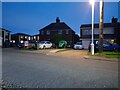
Residents of Dunton have access to a range of nearby amenities, including retail and transport hubs. The area’s proximity to Lidl Biggleswade, Sainsburys Biggleswade, and Co-op Biggleswade ensures convenient shopping options for groceries and everyday essentials. These stores are within practical reach, reducing the need for long journeys to larger towns. For transport, the nearby railway stations—Biggleswade, Sandy, and Arlesey—offer connections to broader regional networks, supporting both local and long-distance travel. While the data does not mention parks or leisure facilities, the presence of these retail and transport links suggests a lifestyle focused on practicality and ease of access. The combination of local shops and rail links makes daily life in Dunton efficient, though those seeking more recreational spaces may need to look beyond the immediate area.
Amenities
Schools
The nearest school to Dunton is Dunton CofE Junior School, a primary institution with an Ofsted rating of ‘good’. This provides a local option for families with young children, though the data does not list any secondary schools in the immediate vicinity. The presence of a primary school with a positive rating suggests that the area can support early education needs, but families requiring secondary schooling may need to look further afield, such as in Biggleswade or Sandy. The school’s ‘good’ rating indicates it meets national standards for teaching quality and student outcomes, though specific details on its curriculum or facilities are not provided. For those prioritising proximity to schools, Dunton offers a basic but functional option, but additional research may be needed for secondary education.
| Rank | A + A* % | School | Type | Entry gender | Ages |
|---|---|---|---|---|---|
| 1 | N/A | Dunton CofE Junior School | primary | N/A | N/A |
Explore more schools in this area
Go to Schools tabDemographics
Dunton’s population is predominantly older, with a median age of 70, the highest of any age group recorded. This reflects a community where many residents have lived for years, if not decades, creating a settled, familiar environment. Home ownership is high, at 72%, indicating a strong presence of long-term residents who have invested in their properties. The data does not specify household composition or accommodation types, but the overall figures suggest a mature demographic profile. The area’s age profile may influence local services, with fewer schools or childcare facilities compared to younger communities. However, the presence of Dunton CofE Junior School indicates some provision for families. The lack of detailed diversity data means it is unclear how the population is distributed across ethnic or religious groups, but the overall figures suggest a homogenous community. For buyers, this demographic profile may appeal to those seeking a quiet, stable environment with minimal turnover.
Household Size
Accommodation Type
Tenure
Ethnic Group
Religion
Household Composition
Age
Household Deprivation
NS-SEC
Explore more demographic insights in this area
Go to Demographics tabPlanning
Planning Constraints
- Crime RiskLocked