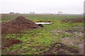
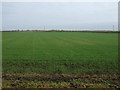
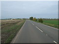
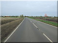
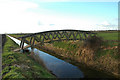
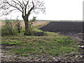
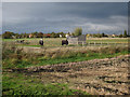
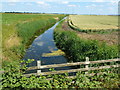
Area Overview for Downham Villages Ward
Photos of Downham Villages Ward
Area Information
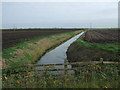
Living in Downham Villages Ward means settling into a distinctive district covering 57.5 km² within England's unitary borough system. You navigate a landscape defined by older demographics and established neighbourhoods rather than rapid modern development. The area functions as a community where daily life revolves around proximity to familiar surroundings rather than high-speed urban connectivity. Your journey here introduces you to a setting where scale and history intersect, creating a residential environment distinct from the broader city fabric. The ward represents a significant portion of local geography, offering space that feels expansive yet contained. Residents here enjoy a specific type of rural-urban interface that shapes their routine. You find that the character of Downham Villages Ward is determined by its boundaries and the people who call it home. The distinction lies in its identity as a structured ward rather than an informal settlement. This classification influences how services operate and how you experience the local plan. When you consider homes in Downham Villages Ward, you are entering a zone with clear administrative definitions. The area size provides room for isolation while maintaining connection to wider transport networks. Your existence here is defined by the 57.5 km² footprint that encompasses various residential pockets. This geography supports a lifestyle where distance to amenities matters as much as proximity to nature. You live within a framework designed for demographic stability and long-term community cohesion.
- Area Type
- District Borough Unitary Ward
- Area Size
- 57.5 km²
- Population
- Not available
- Population Density
- Not available
Demographics
The community in Downham Villages Ward reflects a settled population with a median age of 70. You encounter a neighbourhood where life stages have run their course, resulting in an environment dominated by older adults. Home ownership stands at 79%, which confirms that property is primarily held by those who already reside within the area. This high rate indicates a community built on stability rather than transient rental cohorts. Household composition in this ward leans heavily towards established living arrangements typical of senior citizens. You will not find the rapid turnover associated with student hubs or young professional enclaves. The predominant ethnic group and religious demographics remain unspecified in current records, suggesting a focus on traditional settlement patterns. Your interactions with neighbours centre on shared longevity and established routines. Accommodation types align with the ownership statistics, emphasising permanent residences over temporary dwellings. The total household count supports a steady demand for maintenance services and local healthcare facilities. You might notice lower levels of household formation compared to younger districts, reflecting the age profile. Deprivation presents a challenge within this demographic, as income levels often correlate with age and pension reliance. Income data remains unavailable, yet the age structure implies specific economic needs. Social cohesion thrives alongside potential health challenges inherent to an older population. You interact with residents who value quiet neighbourhoods and reliable local infrastructure. The demographic reality shapes every aspect of daily life in Downham Villages Ward. Society here operates at a different pace, driven by the needs of its senior majority rather than the ambitions of a younger generation.
Household Size
Accommodation Type
Tenure
Ethnic Group
Religion
Household Composition
Age
Household Deprivation
NS-SEC
Explore more demographic insights in this area
Go to Demographics tabPlanning
Planning Constraints
- Flood RiskPremium
- Ramsar Wetland SitesPremium
- Area of Outstanding Natural BeautyPremium
- Protected Nature ReservePremium
- Protected WoodlandPremium