Area Overview for Dovercourt All Saints Ward
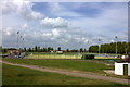
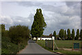
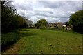
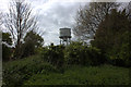
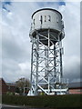
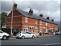
Photos of Dovercourt All Saints Ward


Area Information
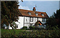
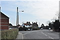
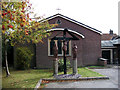
Dovercourt All Saints Ward occupies a distinct pocket within the Tendring District Council area, covering just 2.9 km². This ward serves as a specific administrative unit for the Harwich and North Essex region, situated at coordinates 51.9275°N, 1.2594°E. Living in Dovercourt All Saints Ward means residing in a locality referenced alongside sub-areas like Dovercourt Bay and Dovercourt Tollgate. The area is defined by its local infrastructure rather than major commercial hubs. You will find specific roads such as Main Road, Ramsey Road, Low Road, and Deane's Lane shaping the neighbourhood layout. Nearby amenities include Chase Lane Primary School and Nursery, while recreational space is provided by Abdy Avenue ball court. The ward functions as a quiet residential district within the broader Essex landscape. It does not share an Area of Outstanding Natural Beauty designation, nor does it contain protected nature reserves or protected woodland under current planning constraints. Despite being a small council ward, it possesses specific landmarks that define daily life. Residents navigate a community where local features like Chase Lane Primary School influence the area's character. For those considering homes in Dovercourt All Saints Ward, the setting is modest yet defined by clear boundaries and identifiable local institutions. The area offers a settled environment for those seeking a specific postcode within the Harwich and North Essex landscape.
- Area Type
- District Borough Unitary Ward
- Area Size
- 2.9 km²
- Population
- Not available
- Population Density
- Not available
Demographics
The community makeup of Dovercourt All Saints Ward reveals a distinctly older population. The median age here is 70 years, indicating that the most common age group consists of senior residents. This demographic profile suggests a neighbourhood where retirement or later life stages dominate daily life patterns. With a total household composition and accommodation types recorded against the total population, the ward reflects a settled rather than transient community. Seven out of every ten residents own their homes outright, sitting at 73% home ownership. This high rate of ownership points to a stable area where long-term residents remain. The low population density across just 2.9 km² supports this picture of a quiet, established neighbourhood. You are unlikely to find a mixed-age family hub here; instead, expect an environment catered to older adults. The predominant ethnic group and religion data are recorded as totals, confirming the existence of specific communities within the ward. While specific deprivation figures are absent from the current overview, the age profile suggests services may be tailored to senior needs. Living in Dovercourt All Saints Ward means joining a community built around the lifestyles of those aged 70 and above. This demographic reality shapes everything from local shop hours to community group activities.
Household Size
Accommodation Type
Tenure
Ethnic Group
Religion
Household Composition
Age
Household Deprivation
NS-SEC
Explore more demographic insights in this area
Go to Demographics tabPlanning
Planning Constraints
- Flood RiskPremium
- Ramsar Wetland SitesPremium
- Area of Outstanding Natural BeautyPremium
- Protected Nature ReservePremium
- Protected WoodlandPremium
- Crime RiskPremium