Area Overview for Croydon
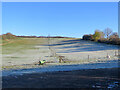
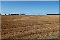
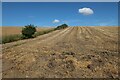
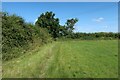
Photos of Croydon


Area Information
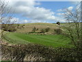
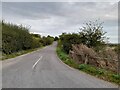
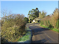
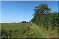
Croydon is a civil parish situated in England that covers an area of 11.1 km². This relatively compact size shapes how residents experience daily life, limiting travel distances within the local community. You will find a neighbourhood defined by established routines rather than rapid urban expansion. The classification as a parish suggests a governance structure that caters to local needs at a parish council level. Living in Croydon means prioritising proximity to local amenities over sprawling suburban sprawl. The geographic footprint is significant enough to support independent services yet small enough to maintain a recognisable street-level character. Your journey through this parish involves navigating a defined boundary where the built environment interacts closely with the land underneath. This setting offers a distinct alternative to larger metropolitan boroughs, providing a sense of place anchored by clear administrative limits. Settlements of this scale often foster familiarity among neighbours who know the geography intimately. You move through an area where the physical constraints of 11.1 km² dictate a pace of life rooted in local patterns. The identity of the area remains tied to its specific designation and historical footprint rather than continuous growth narratives. Daily existence here is structured around walking distances and local landmarks visible within this specific civil parish boundary.
- Area Type
- Parish
- Area Size
- 11.1 km²
- Population
- Not available
- Population Density
- Not available
Demographics
The community profile of Croydon is defined by a median age of 70 years. This figure places Croydon significantly older than the national average for the United Kingdom. A predominance of residents in or near this age bracket suggests the area attracts retirees and older families. You might encounter fewer young professionals or university students living permanently within these boundaries. Household composition data indicates a stable demographic structure typical of retirement-friendly locations. Home ownership stands at 74%, revealing a territory where purchase has outweighed renting for the vast majority. This high rate of ownership implies long-term residents who have invested in their local addresses. Most households fall into the total age category, reinforcing the dominance of the 70-year-old demographic midpoint. The accommodation portfolio reflects the tenure structure, with a heavy weighting towards properties owned outright or with mortgages by older owners. Ethnical diversity and religious breakdown figures are not specified in the current records, so the public picture relies heavily on age and tenure. You can expect a quieter, more settled atmosphere where tradition and stability form the backdrop to everyday social interactions. The lack of younger demographics shapes the local culture, schools, and retail offerings available to you.
Household Size
Accommodation Type
Tenure
Ethnic Group
Religion
Household Composition
Age
Household Deprivation
NS-SEC
Explore more demographic insights in this area
Go to Demographics tabPlanning
Planning Constraints
- Flood RiskPremium
- Ramsar Wetland SitesPremium
- Area of Outstanding Natural BeautyPremium
- Protected Nature ReservePremium
- Protected WoodlandPremium
- Crime RiskPremium