Area Overview for Croxley Green
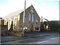
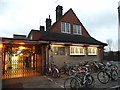
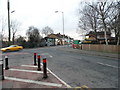
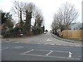
Photos of Croxley Green
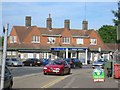
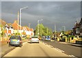
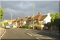
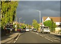

Area Information
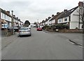
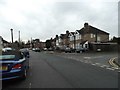
Living in Croxley Green offers a distinct experience within a compact civil parish that spans just 5.0 km². The area is defined by a specific demographic reality, as it hosts a population of 4,361 residents. This relatively small community size creates an environment where daily life feels contained compared to larger urban districts. The dense living arrangement sees 1 person for every 871 square metres, indicating a high population density that shapes the rhythm of neighbourhood interactions. You will find that the area functions as a self-contained unit rather than a sprawling expanse of development. Recent data reveals an older demographic profile, with a median age of 70 for the total population. This suggests the parish is home to many retirees or long-term residents rather than families raising young children. The concentration of older adults influences local services and the character of the streets. While the area lacks the vibrancy of a youth centre, it offers a quiet, settled atmosphere for those who prefer a slower pace. The combination of limited land area and an aging population means housing demand and community needs differ significantly from younger, family-heavy suburbs. Anyone considering homes in this parish must account for a community built around stability and established residency patterns.
- Area Type
- Parish
- Area Size
- 5.0 km²
- Population
- 4361
- Population Density
- 871 people/km²
Demographics
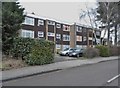
Understanding the community in Croxley Green requires looking at precise household figures. The most current statistics show a home ownership rate of 81%. This high percentage indicates that the vast majority of households own their properties outright or have a significant equity stake. Consequently, the local culture revolves around stability rather than the transient nature often found in rental markets. With 81% of residents being owners, decisions about local improvements or community groups likely reflect owner-occupier priorities. The demographic data does not provide specific breakdowns for household composition types, accommodation details beyond ownership status, or ethnic group distributions. However, the safety metrics offer a clear picture of the neighbourhood quality. The area achieves a safety score of 80 out of 100, which places it in the low crime risk category. This statistic means the parish records below-average crime rates compared to the wider region. Such a low crime environment supports a secure feeling for residents of all ages. The absence of data on specific deprivation indices or detailed household sizes prevents speculation, but the high ownership rate and low crime score paint a consistent picture of a safe, settled community where residents have a strong stake in their locality.
Household Size
Accommodation Type
Tenure
Ethnic Group
Religion
Household Composition
Age
Household Deprivation
NS-SEC
Explore more demographic insights in this area
Go to Demographics tabPlanning
Planning Constraints
- Flood RiskPremium
- Ramsar Wetland SitesPremium
- Area of Outstanding Natural BeautyPremium
- Protected Nature ReservePremium
- Protected WoodlandPremium
- Crime RiskPremium