Area Overview for Crostwick
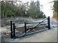
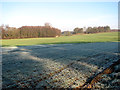
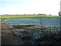
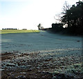
Photos of Crostwick
Area Information
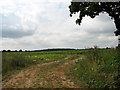
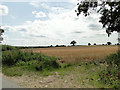
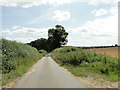
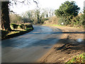
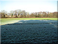
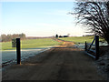
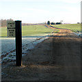
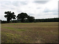
Living in Crostwick offers a distinctively quiet existence within the civil parish of Horstead with Stanninghall, located in the Broadland district of Norfolk. This small village covers an area of just 2.7 square kilometres and sits approximately 2.6 miles west of Wroxham and 5.6 miles north of Norwich. The B1150 road bisects the settlement, providing direct access between these two larger towns. Historically, the name derives from Old Norse, marking a clearing around a cross recorded in the Domesday Book of 1086. During the Second World War, parts of the village functioned as a decoy airfield to distract enemy aircraft from nearby RAF Horsham St Faith. Architecture and history define the daily rhythm here, highlighted by St. Peter's Church, a Grade I listed building dating from the fifteenth century. This Grade I listed structure features a medieval wall-painting of Saint Christopher and stained-glass windows by William Wailes restored in 1989. Commuters value the location for its proximity to Norwich and its proximity to the Broads, yet the rural character remains intact. You will find yourself surrounded by green space and historic stone buildings, balancing historical intrigue with modern accessibility to the wider county. ### The community demographic profile reveals a settlement with a significant portion of older residents. The median age for the population stands at 70 years, making it one of the older populations in the region. Most households align with this age profile, suggesting a community where retirement or later life is common. approximately 74 per cent of homes are owner-occupied, indicating a strong tradition of family ownership rather than long-term renting. This high rate of home ownership often reflects a preference for stability and low maintenance living arrangements suitable for the demographic present. The data does not specify the breakdown of household composition by family size, so it remains unclear if single-person households prevail alongside couples without dependent children. Diversity metrics regarding predominant ethnic groups and religious affiliation are also not detailed in the available figures. For those researching homes in Crostwick, the demographic snapshot points toward a settled, mature community with established roots. The high level of home ownership suggests a market driven by purchase rather than investment renting, which can impact local character and neighbourly dynamics. ### The housing market in Crostwick is characterised by a predominantly owner-occupied stock, with 74 per cent of properties held by their residents. This high figure suggests a stable market where families choose to buy rather than rent. The remaining properties fall into the rented sector or other accommodation types, though specific figures for private versus social renting are not provided. You are likely to find traditional housing stock reflecting the village's origins in the Domesday Book era, alongside mid-20th century builds. The area size of just 2.7 square kilometres limits the total number of properties available, potentially creating competition for specific parcels of land. Buyers considering homes in Crostwick should expect a limited selection typical of a small civil parish. The separation of accommodation types is not explicitly detailed, meaning the mix of homes could range from listed period properties to modern self-builds. Historical records note the village was divided between the estates of Ralph de Beaufour and Roger de Poitou, hinting at an inheritance-based property history. When looking at properties for sale, you are entering a niche market where high home ownership frequently correlates with a less transient resident base. ### Safety and environmental assessments for Crostwick present a mixed picture of risk and planning constraints. The crime risk assessment scores 90 out of 100, indicating a low crime risk and below-average crime rates compared to similar areas. This safe neighbourhood status is a key selling point for residents and prospective buyers alike. Conversely, the flood risk assessment gives a score of 5.53, which represents low flood risk coverage. You can live in this area with minimal concern regarding water-related flooding. However, two planning constraints warrant your attention. The area contains Ramsar wetland sites, yielding a warning-level score of 2.19. This constraint may limit development potential in specific zones due to their protected ecological status. Additionally, the village contains protected nature reserves, another warning-level factor with a score of 2.18. These designations do not indicate immediate danger but do influence future planning permissions. The Area of Outstanding Natural Beauty assessment passes with a score of 0, confirming no AONB coverage, while protected woodland is also absent with a score of 0. These factors ensure that while the land is protected for nature, it does not carry the strict restrictions of a designated natural beauty area. ### Who typically lives in Crostwick?The median age of residents is 70 years, indicating a mature community. Most common household ages align with this higher median. Approximately 74 per cent of homes are owner-occupied, suggesting a stable population of long-term residents rather than transient renters. Is Crostwick a safe place to live?Yes, the area boasts a safety score of 90 out of 100 based on crime risk assessments. This indicates low crime risk and below-average crime rates compared to surrounding regions. Flood risk is also low with a score of 5.53, making it a secure environment for families and retirees. Are there restrictions on building or development?There are specific planning constraints. The area contains Ramsar wetland sites and protected nature reserves, both flagged as warnings with a score of 2.19. These designations mean development in these specific zones may be restricted to protect local wildlife and ecological balances. How far is Crostwick from major towns?The village is located approximately 2.6 miles west of Wroxham and 5.6 miles north of Norwich. It sits on the B1150 road, which bisects the village and provides direct links between Norwich and North Walsham for commuting purposes.
- Area Type
- Parish
- Area Size
- 2.7 km²
- Population
- Not available
- Population Density
- Not available
Demographics
The community demographic profile reveals a settlement with a significant portion of older residents. The median age for the population stands at 70 years, making it one of the older populations in the region. Most households align with this age profile, suggesting a community where retirement or later life is common. approximately 74 per cent of homes are owner-occupied, indicating a strong tradition of family ownership rather than long-term renting. This high rate of home ownership often reflects a preference for stability and low maintenance living arrangements suitable for the demographic present. The data does not specify the breakdown of household composition by family size, so it remains unclear if single-person households prevail alongside couples without dependent children. Diversity metrics regarding predominant ethnic groups and religious affiliation are also not detailed in the available figures. For those researching homes in Crostwick, the demographic snapshot points toward a settled, mature community with established roots. The high level of home ownership suggests a market driven by purchase rather than investment renting, which can impact local character and neighbourly dynamics. ### The housing market in Crostwick is characterised by a predominantly owner-occupied stock, with 74 per cent of properties held by their residents. This high figure suggests a stable market where families choose to buy rather than rent. The remaining properties fall into the rented sector or other accommodation types, though specific figures for private versus social renting are not provided. You are likely to find traditional housing stock reflecting the village's origins in the Domesday Book era, alongside mid-20th century builds. The area size of just 2.7 square kilometres limits the total number of properties available, potentially creating competition for specific parcels of land. Buyers considering homes in Crostwick should expect a limited selection typical of a small civil parish. The separation of accommodation types is not explicitly detailed, meaning the mix of homes could range from listed period properties to modern self-builds. Historical records note the village was divided between the estates of Ralph de Beaufour and Roger de Poitou, hinting at an inheritance-based property history. When looking at properties for sale, you are entering a niche market where high home ownership frequently correlates with a less transient resident base. ### Safety and environmental assessments for Crostwick present a mixed picture of risk and planning constraints. The crime risk assessment scores 90 out of 100, indicating a low crime risk and below-average crime rates compared to similar areas. This safe neighbourhood status is a key selling point for residents and prospective buyers alike. Conversely, the flood risk assessment gives a score of 5.53, which represents low flood risk coverage. You can live in this area with minimal concern regarding water-related flooding. However, two planning constraints warrant your attention. The area contains Ramsar wetland sites, yielding a warning-level score of 2.19. This constraint may limit development potential in specific zones due to their protected ecological status. Additionally, the village contains protected nature reserves, another warning-level factor with a score of 2.18. These designations do not indicate immediate danger but do influence future planning permissions. The Area of Outstanding Natural Beauty assessment passes with a score of 0, confirming no AONB coverage, while protected woodland is also absent with a score of 0. These factors ensure that while the land is protected for nature, it does not carry the strict restrictions of a designated natural beauty area. ### Who typically lives in Crostwick?The median age of residents is 70 years, indicating a mature community. Most common household ages align with this higher median. Approximately 74 per cent of homes are owner-occupied, suggesting a stable population of long-term residents rather than transient renters. Is Crostwick a safe place to live?Yes, the area boasts a safety score of 90 out of 100 based on crime risk assessments. This indicates low crime risk and below-average crime rates compared to surrounding regions. Flood risk is also low with a score of 5.53, making it a secure environment for families and retirees. Are there restrictions on building or development?There are specific planning constraints. The area contains Ramsar wetland sites and protected nature reserves, both flagged as warnings with a score of 2.19. These designations mean development in these specific zones may be restricted to protect local wildlife and ecological balances. How far is Crostwick from major towns?The village is located approximately 2.6 miles west of Wroxham and 5.6 miles north of Norwich. It sits on the B1150 road, which bisects the village and provides direct links between Norwich and North Walsham for commuting purposes.
Household Size
Accommodation Type
Tenure
Ethnic Group
Religion
Household Composition
Age
Household Deprivation
NS-SEC
Explore more demographic insights in this area
Go to Demographics tabPlanning
Planning Constraints
- Flood RiskPremium
- Ramsar Wetland SitesPremium
- Area of Outstanding Natural BeautyPremium
- Protected Nature ReservePremium
- Protected WoodlandPremium
- Crime RiskPremium