Area Overview for Cromer Town Ward
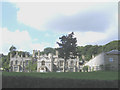
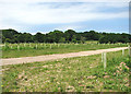
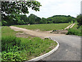
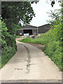
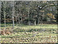
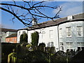
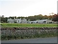
Photos of Cromer Town Ward

Area Information
Living in Cromer Town Ward offers a defined life within a compact coastal footprint. This electoral ward sits within the North Norfolk District in eastern England, covering a precise land area of 3.1 km². You are looking at a location situated approximately 23 miles north of Norwich, centred around the small coastal town of Cromer. The specific coordinates place the ward near 52.93° N and 1.30° E, offering a geographically distinct pocket in the region. Daily life here revolves around its status as part of a larger town structure while maintaining guardrail proximity to the coast. Community members rely on the Cromer Railway Station for their transport links, connecting them to the wider Norfolk network. The ward encompasses specific parts of Cromer, blending residential needs with local coastal character. You gain access to a fixed environment where the boundaries are clear and the geography is measurable. This setting provides a tangible sense of place rather than an abstract urban sprawl. The area's identity is tied firmly to its role as a local ward serving North Norfolk District residents. Prospective buyers here know exactly what land they are examining. The 3.1 km² boundary defines the scope of your immediate surroundings. You engage with a community that values its specific location along the English coast. Transport options depend on the railway station serving the locality. Your view of the world from Cromer Town Ward is shaped by these strict geographic and administrative lines.
- Area Type
- District Borough Unitary Ward
- Area Size
- 3.1 km²
- Population
- Not available
- Population Density
- Not available
Demographics
The community in Cromer Town Ward reflects a predominantly mature population. You are moving into an area where the median age is 70 years old. This demographic profile indicates a neighbourhood heavily weighted towards older residents. The most common age range data simply lists "Age: Total", confirming the statistical breakdown without further sub-division in the provided records. This age skew suggests a quiet residential environment rather than a youthful, family-heavy hub. Property ownership is the standard living arrangement here, with 59% of properties owned outright or with a mortgage. This high level of homeownership points to long-term stability and residents who have likely settled permanently. The remaining 41% of households comprise renters or those with different tenure statuses. You do not have specific data on household composition types such as singles, couples, or families, so you cannot assume a diverse mix of family units. Similarly, details on predominant ethnic group and religious affiliation are not available in the current records. The accommodation type data is also listed generally as "total" without breaking down bedsits, terraced homes, or detached houses. While specific deprivation indices are not listed in the figures, the high homeownership rate often correlates with established neighbourhoods. You should consider the implications of a 70-year-old median age when visiting schools near Cromer Town Ward, as the local catchment may serve a different generation. Your interaction with neighbours will likely involve an older demographic. The lack of granular diversity statistics means you rely on the broader coastal context for cultural expectations.
Household Size
Accommodation Type
Tenure
Ethnic Group
Religion
Household Composition
Age
Household Deprivation
NS-SEC
Explore more demographic insights in this area
Go to Demographics tabPlanning
Planning Constraints
- Flood RiskPremium
- Ramsar Wetland SitesPremium
- Area of Outstanding Natural BeautyPremium
- Protected Nature ReservePremium
- Protected WoodlandPremium
- Crime RiskPremium