Area Overview for Crimplesham
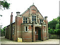
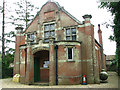
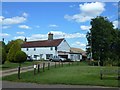
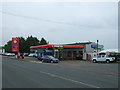
Photos of Crimplesham
Area Information
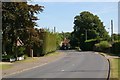
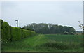
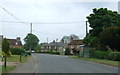
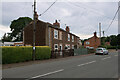
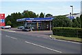
Living in Crimplesham means settling into a civil parish that covers 6.6 square kilometres of suburban space. You find a distinct sense of stability here, far removed from the chaotic pace of larger Kentish towns. The area functions as a quiet residential hub where daily life revolves around established neighbourhood patterns rather than rapid development. Prospective buyers looking at homes in Crimplesham will find a landscape defined by its established character and lack of major planning constraints. There are no Ramsar wetland sites, Areas of Outstanding Natural Beauty, or protected nature reserves within the parish boundaries. This clarity simplifies the planning environment for future investments. The demographic profile suggests a mature community where residents value permanence over constant flux. You can expect a setting where the pace of life is generally moderate, supported by low flood risk and minimal environmental planning barriers. The area offers a straightforward proposition for those seeking a predictable living environment without the complexities often associated with protected landscapes. It is a chosen place for long-term residents who appreciate a defined boundary and consistent neighbourhood identity.
- Area Type
- Parish
- Area Size
- 6.6 km²
- Population
- Not available
- Population Density
- Not available
Demographics
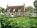
The community in Crimplesham is defined by a notably settled population, with a median age of 70 years. This statistic reflects a neighbourhood dominated by older residents who have chosen to downsize or remain in their family homes. Data indicates that age represents the total household composition, meaning the area does not cater primarily to young families or students. Home ownership stands at 74%, establishing Crimplesham as a territory where most people live in their own property rather than renting. This high rate of ownership signals deep roots and a community invested in the long-term stability of the local environment. The district operates as a closed loop of residents who have stayed or bought into the area over decades. While specific details on predominant ethnic groups and religious affiliations are not part of the current dataset, the housing stock points toward a traditional settlement pattern. You will encounter a society characterised by senior living, where lifestyle priorities often centre on comfort, access to local services, and proximity to nature rather than urban entertainments. This demographic profile creates a unique social fabric distinct from younger, fast-growing suburbs.
Household Size
Accommodation Type
Tenure
Ethnic Group
Religion
Household Composition
Age
Household Deprivation
NS-SEC
Explore more demographic insights in this area
Go to Demographics tabPlanning
Planning Constraints
- Flood RiskLocked
- Ramsar Wetland SitesLocked
- Area of Outstanding Natural BeautyLocked
- Protected Nature ReserveLocked
- Protected WoodlandLocked
- Crime RiskLocked