Area Overview for Cressing
Photos of Cressing
Area Information
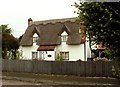
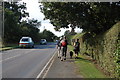
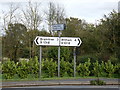
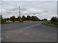
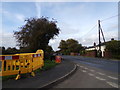
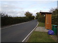
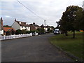
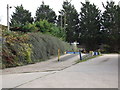
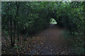
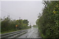
Living in Cressing offers a defined connection to history within a rural parish setting. This civil parish spans 10.5 km² in the Braintree district of Essex, positioned between Braintree and Witham. The area encompasses the main village plus the hamlet of Hawbush Green and the village of Tye Green. Cressing Temple sits 1.5 miles south of the village centre, marking a site of significant heritage tied to the Knights Templar and adjacent to the River Brain. Archaeological records confirm human occupation from the Late Bronze Age and Iron Age, with an Iron Age settlement present by the first century BC. Romans invaded nearby Colchester in 43 AD, leaving traces such as pottery and tile fragments in the surrounding region. Field Marshal Sir Evelyn Wood, a Victoria Cross recipient, was born in this location. The community maintains a friendly character supported by active local groups like the Cressing Sports and Social Club. Residents have access to two churches and listed buildings, including one featuring a Nevill monument and brass. You will find practical amenities such as the public house Fowlers Farm and the top-rated restaurant Il Salice. Daily life balances proximity to key towns with the quiet of the countryside. The area includes two distinct main roads linking the village, likely of Roman origin, alongside transport links near the A120.
- Area Type
- Parish
- Area Size
- 10.5 km²
- Population
- Not available
- Population Density
- Not available
Demographics
The community in Cressing has a clear demographic profile with a median age of 70 years. This figure indicates a population heavily skewed towards older residents compared to national averages. The most common age range covers the total population, reinforcing that the majority of people here are elderly. With 73% of households owning their homes, Cressing acts primarily as a retirement location or a destination for those seeking stability in property ownership. The remainder of the local group consists of tenants or shared ownership residents. Determining a precise ethnic breakdown is difficult because the data does not specify a predominant group beyond a general total. Similarly, detailed religious statistics are not available to define the spiritual makeup of the village. However, historical records note that the Knights Templar were established here in 1137 when Matilda granted the land to the order. Later, the site became a preceptory that eventually transferred to the Knights Hospitallers. This history provides cultural context even without current religious census figures. The low proportion of young families likely contributes to an environment where quiet enjoyment of historic surroundings takes precedence over playground activity or vibrant nightlife.
Household Size
Accommodation Type
Tenure
Ethnic Group
Religion
Household Composition
Age
Household Deprivation
NS-SEC
Explore more demographic insights in this area
Go to Demographics tabPlanning
Planning Constraints
- Flood RiskPremium
- Ramsar Wetland SitesPremium
- Area of Outstanding Natural BeautyPremium
- Protected Nature ReservePremium
- Protected WoodlandPremium