Area Overview for Cranfield & Marston Moretaine Ward
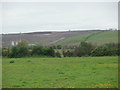
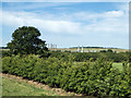
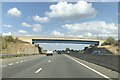
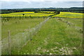
Photos of Cranfield & Marston Moretaine Ward


Area Information
Living in Cranfield & Marston Moretaine Ward offers a distinct experience within Central Bedfordshire. This unitary authority ward spans 62.6 km² and is home to 10,171 residents. You will find the area encompasses two settlements, Cranfield and Marston Moretaine, situated in the East of England region. The coordinates place this local community in the vicinity of Marston Moretaine, which uses the MK43 0 postcode district. As one of 31 wards administered by Central Bedfordshire Council, the area provides a defined administrative structure for local governance. Daily life here revolves around two specific towns rather than a single large urban centre. The ward is part of the Central Bedfordshire Council administrative division, ensuring dedicated representation through local councillors. You are looking at a specific slice of central England where the ward coordinates centre around the village of Marston Moretaine. The local geography supports a settled lifestyle within these boundaries. Prospective buyers should note that your home search will focus on these two established communities. The area represents a stable residential zone under the jurisdiction of the council. Understanding the specific location is vital for anyone considering homes in Cranfield & Marston Moretaine Ward. The ward sits within the broader East of England region while maintaining its identity as a Central Bedfordshire locality. This dual identity shapes the local services and planning definitions you will encounter. Whether you seek a connection to the MK43 postcodes or the wider ward statistics, the data confirms a coherent residential district managed by a single authority.
- Area Type
- District Borough Unitary Ward
- Area Size
- 62.6 km²
- Population
- 10171
- Population Density
- 162 people/km²
Demographics
The community profile in Cranfield & Marston Moretaine Ward reflects a mature population. With a median age of 70, the neighbours you meet here are typically senior residents. This statistical fact defines the daily rhythm of the area, suggesting a neighbourhood where life often slows down as retirees settle into their homes. The most common age range listed in the available records is simply marked as "Total Age", indicating a broad spread across the elderly demographic. Home ownership stands as a defining characteristic of the area. A full 76% of residents own their property outright or with a mortgage. This high figure confirms that the ward is primarily an owner-occupied community rather than a lettings market. You will find long-term residents who have built their lives within Cranfield & Marston Moretaine Ward. The prevailing household composition and accommodation type data are recorded as "Total", meaning no specific breakdown of family sizes or housing stock exists in the current records. Diversity metrics such as predominant ethnic group and religious affiliation are recorded as "Total" in the dataset. While this indicates specific figures are not broken out, the dominant theme remains the older, settled population. Deprivation data is absent from the current information, so any assessment of quality of life relies on the stability of home ownership and safety scores. The lack of specific age breakdowns means you cannot distinguish between working-age retirees and younger demographics. However, the 76% ownership rate remains the strongest indicator of community stability.
Household Size
Accommodation Type
Tenure
Ethnic Group
Religion
Household Composition
Age
Household Deprivation
NS-SEC
Explore more demographic insights in this area
Go to Demographics tabPlanning
Planning Constraints
- Flood RiskPremium
- Ramsar Wetland SitesPremium
- Area of Outstanding Natural BeautyPremium
- Protected Nature ReservePremium
- Protected WoodlandPremium
- Crime RiskPremium