Area Overview for Covehithe
Photos of Covehithe

Area Information
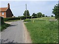
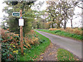
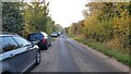
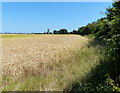
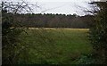
Living in Covehithe means residing in a tiny civil parish that covers just 4.7 km² on the North Sea coast of East Suffolk. This remote hamlet sits approximately 4 miles north of Southwold and 7 miles south of Lowestoft, placing it deep within the Benacre Estate which has belonged to the Gooch family since 1746. The character of the area is defined by its isolation and a profound sense of impermanence. You are surrounded by cliffs that recede at a rate of about 5 metres per year due to relentless sea action and storms. Locals describe this as an edgeland feel, where rural simplicity meets the threat of coastal disappearance within 80 years. Despite the looming environmental challenge, daily life revolves around a serene atmosphere protected by historic landmarks. The most notable feature is the ruins of the medieval Church of St Andrew. This 14th to 15th-century structure retains a 100-ft tower that served as a navigational beacon after the main church was dismantled in 1672. Inside these old walls, a smaller thatched church built in the same year still stands and remains in use. It holds 15th-century items including a carved octagonal font. Nearby, Benacre Broad offers an isolated coastal lagoon experience within the Benacre National Nature Reserve. Transport links are minimal; the nearest railway station is Carlton-Colville, located 6¼ miles away to the north west. You must rely on the A12 road for most journeys, as there are limited bus services in this rural setting.
- Area Type
- Parish
- Area Size
- 4.7 km²
- Population
- Not available
- Population Density
- Not available
Demographics
The community in Covehithe reflects its status as a small, stable settlement with very little demographic turnover. The overall population hovers around 20 people, a figure that aligns with the 15 homes recorded in the Domesday Book of 1086. Your neighbour will likely be an older resident, as the median age in the area is 70 years old. Most residents fall into the broad "Total Age" category, indicating a uniformity in the age structure. Homeownership is the dominant form of tenure, with 68% of properties owned outright or with a mortgage. This high level of ownership suggests a settled community rather than a transient rental market. The area lacks significant diversity in household composition, religion, or ethnicity, which is typical for a hamlet of this size and age. Deprivation is not a factor here, as the community thrives on agricultural roots and estate ownership. The Gooch family has managed the land for centuries, ensuring consistent land use. While the population is small, the presence of active residents maintains local institutions like the thatched church. If you are considering living in Covehithe, you should expect a quiet existence where you know everyone by sight. The lack of commercial development means you will rely on external towns for retail needs. The demographic profile confirms this is a place for those seeking solitude and connection to history rather than urban convenience.
Household Size
Accommodation Type
Tenure
Ethnic Group
Religion
Household Composition
Age
Household Deprivation
NS-SEC
Explore more demographic insights in this area
Go to Demographics tabPlanning
Planning Constraints
- Flood RiskPremium
- Ramsar Wetland SitesPremium
- Area of Outstanding Natural BeautyPremium
- Protected Nature ReservePremium
- Protected WoodlandPremium
- Crime RiskPremium