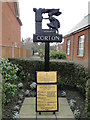
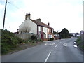
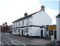
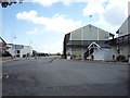
Area Overview for Corton
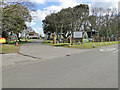
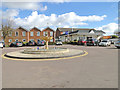
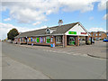
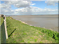
Photos of Corton
Area Information
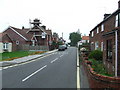
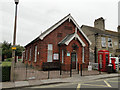
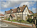
Corton is a built-up area in England, covering 45.3 hectares and functioning as a small town or city. Its population is predominantly older, with a median age of 70, suggesting a community shaped by long-term residents. The area is compact, with a mix of residential and commercial spaces that support daily life. Corton’s proximity to amenities like schools, retail outlets, and rail stations makes it practical for residents. The high home ownership rate of 80% indicates a stable, settled population, though the exact composition of household types is not detailed. Living here offers access to essential services within a short distance, including two major railway stations and a range of shops. The area’s character is defined by its quiet, established nature, with a focus on convenience over sprawling development. For those seeking a low-maintenance, community-oriented lifestyle, Corton provides a balance of accessibility and tranquillity.
- Area Type
- Built Up Area 250
- Area Size
- 45.3 hectares
- Population
- Not available
- Population Density
- Not available
Corton offers a practical lifestyle with easy access to essential amenities. The area has five retail outlets, including Tesco Lowestoft, Tesco Hollingsworth, and Aldi Millennium, providing shopping options for daily needs. Residents can also reach five rail stations, such as Lowestoft Railway Station, which connects to broader transport networks. While the data does not mention parks or leisure facilities, the proximity to retail and transport hubs suggests a focus on convenience. The compact size of the area means amenities are within walking or short driving distance, reducing the need for long commutes. The mix of shops and rail links supports a self-sufficient lifestyle, though the lack of details on recreational spaces means the full range of leisure options is not specified.
Amenities
Schools
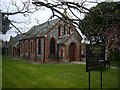
The primary school closest to Corton is the Corton Church of England Voluntary Aided Primary School, which holds a ‘good’ Ofsted rating. This school serves the local community, offering education for younger children in a setting that aligns with the area’s demographic profile. The absence of secondary schools in the data means the area may rely on nearby towns for further education. The presence of a well-rated primary school is a key consideration for families with young children, as it provides a local option for early education. However, the lack of information on other schools or educational facilities means the full range of options is not clear. For those prioritising a strong foundation in primary education, Corton’s school meets the standard required for a family-focused move.
| Rank | School | Type | Entry gender | Ages |
|---|
Explore more schools in this area
Go to Schools tabDemographics
Corton’s population has a median age of 70, which is notably higher than the national average. This suggests a community largely composed of older adults, many of whom may have lived in the area for decades. The home ownership rate is 80%, indicating that most residents own their homes rather than rent. The data does not specify the exact distribution of household types, accommodation styles, or ethnic diversity, but the ‘total’ category implies a broad mix. The high median age may influence local services and amenities, with a focus on healthcare and community support. While the data does not quantify deprivation levels, the combination of high home ownership and established infrastructure suggests a relatively stable quality of life. However, the lack of detailed demographic breakdowns means assumptions about diversity or younger family populations are not supported by the available information.
Household Size
Accommodation Type
Tenure
Ethnic Group
Religion
Household Composition
Age
Household Deprivation
NS-SEC
Explore more demographic insights in this area
Go to Demographics tabPlanning
Planning Constraints
- Crime RiskPremium