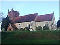
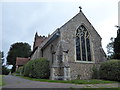
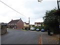
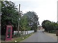
Area Overview for The Colnes Ward
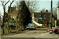
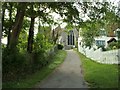
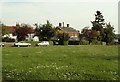
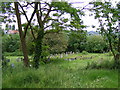
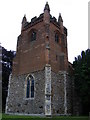
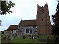
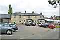
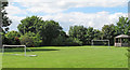
Photos of The Colnes Ward
Area Information
Living in The Colnes Ward offers a distinct residential experience within a carefully defined boundary. This district borough unitary ward covers an area of 36.3 square kilometres, providing sufficient space for residents to spread out without feeling isolated. You will find a population of 1,862 people calling this location home, which creates a relatively intimate community atmosphere compared to larger urban districts. The setting is characterised by low population density figures, averaging 1,380 people per square kilometre. This figure suggests a quiet environment where neighbours are familiar but not overwhelming. Daily life here revolves around a tight-knit group rather than the anonymity of a major city centre. The ward exists as a self-contained entity within the broader England structural framework, offering residents a specific identity separate from surrounding large towns. Prospective buyers looking for space and a sense of calm will find the physical footprint of the ward aligns with those preferences. The modest size ensures that local services and community gatherings remain accessible to the entire demographic. You are looking at an area where the built environment does not interfere heavily with the natural spacing between households. This balance between land use and population count defines the current character of the locality.
- Area Type
- District Borough Unitary Ward
- Area Size
- 36.3 km²
- Population
- 1862
- Population Density
- 1380 people/km²
Demographics
The community profile of The Colnes Ward reveals a significant demographic shift towards retirement living. Your potential neighbours are predominantly older residents, with a median age of 70 years across the ward. This statistic indicates that the area serves as a key location for retirees rather than young families seeking a change. While the most common age range data is listed under the total category, the high median age strongly suggests a silver community dynamic. Social activity here likely centres around pensioners' groups and care-focused initiatives rather than youth sports or teenage nightlife. You should expect a society where intergenerational interaction takes on a specific rhythm defined by this age concentration. Home ownership stands at a robust 72%, meaning nearly three out of every four residents own their property outright or with a mortgage. This high ownership rate often correlates with stability and community participation. The local economy reflects this tenure structure, with homeowners holding significant power in council decisions and local planning matters. Household composition data is recorded under the total category, but the ownership figure implies fewer temporary migrants passing through. Diversity metrics such as ethnicity and religion are recorded under total categories without specific breakdowns provided in the source data. Consequently, the social fabric appears unified by age and tenure rather than a mix of varied cultural backgrounds. You are joining a community where long-term settlement is the norm.
Household Size
Accommodation Type
Tenure
Ethnic Group
Religion
Household Composition
Age
Household Deprivation
NS-SEC
Explore more demographic insights in this area
Go to Demographics tabPlanning
Planning Constraints
- Flood RiskPremium
- Ramsar Wetland SitesPremium
- Area of Outstanding Natural BeautyPremium
- Protected Nature ReservePremium
- Protected WoodlandPremium
- Crime RiskPremium