Area Overview for Coastal Ward
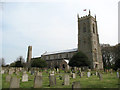
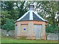
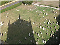
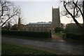
Photos of Coastal Ward
Area Information
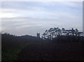
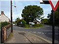
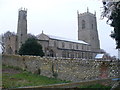
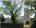
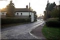
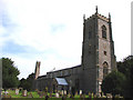
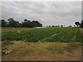
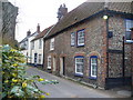
Living in Coastal Ward defines a life on the edge of England where scenery and stability meet. This district borough unitary ward covers 66.7 km², offering a substantial footprint for residents to explore. The area functions as a quiet retreat rather than a bustling hub, characterised by its spaciousness and established nature. You will find yourself in a location that prioritises tranquility over intensity, perfect for those seeking a slower pace of life. The landscape here is defined by protected areas, including significant sections within an Area of Outstanding Natural Beauty usage. This designation ensures that the visual beauty of the ward remains intact for future generations. It also means you encounter specific planning constraints that protect this unique environment. Daily life revolves around a deep connection to the natural surroundings, which include Ramsar wetland sites and protected nature reserves. These features shape the rhythm of the neighbourhood, offering residents access to wide open spaces. While the area lacks high-density development, the 66.7 km² size provides enough room for a diverse range of outdoor pursuits without overwhelming noise levels. You are not looking for a city centre experience here; instead, you choose a setting where the prioritisation of safety and conservation takes precedence. The result is a living environment where the dominant theme is one of peaceful coexistence with a preserved landscape.
- Area Type
- District Borough Unitary Ward
- Area Size
- 66.7 km²
- Population
- Not available
- Population Density
- Not available
Demographics
The community in Coastal Ward displays a very distinct demographic profile, centred almost entirely around an older population. The median age stands at 70, indicating that the vast majority of households are elderly. This means you will spend your days amidst mature residents who have built long-term ties to the locality. Such an age distribution often suggests a population that is settled and rooted, rather than transient or young families moving in frequently. Home ownership is exceptionally high here, with 76% of residents owning their homes outright or with a mortgage. This level of stability contributes to a quiet social fabric where neighbours understand each other's history. Household composition reflects this senior demographic, suggesting smaller households or individuals living alone rather than large families. The area feels like a retirement之境 or a place chosen for its calm atmosphere. This demographic reality impacts local services and the general vibe of the neighbourhood. You will encounter a community where life moves at a deliberate pace. The lack of young families or students changes how public spaces are used during the day. Older residents tend to stay local, fostering strong, long-standing neighbourhood bonds. Therefore, if you value a community built on decades-occupation history, Coastal Ward fits that description perfectly. The statistics painted a clear picture of a place defined by longevity and stability.
Household Size
Accommodation Type
Tenure
Ethnic Group
Religion
Household Composition
Age
Household Deprivation
NS-SEC
Explore more demographic insights in this area
Go to Demographics tabPlanning
Planning Constraints
- Flood RiskPremium
- Ramsar Wetland SitesPremium
- Area of Outstanding Natural BeautyPremium
- Protected Nature ReservePremium
- Protected WoodlandPremium
- Crime RiskPremium