Area Overview for CO9 4HD
Photos of CO9 4HD
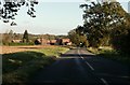
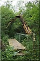
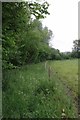
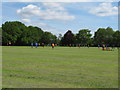
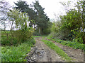
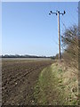
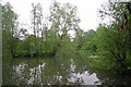
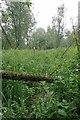
13 photos from this area
Area Information
Key information about the CO9 4HD including its size, population, and administrative classification.
- Area Type
- Postcode
- Area Size
- 8.0 hectares
- Population
- 2303
- Population Density
- 178 people/km²
House Prices in CO9 4HD
18
Properties
£357,900
Average Sold Price
£79,000
Lowest Price
£645,000
Highest Price
Showing 18 properties
| Address | Type | Beds | Baths | Last Sale Price | Last Sale Date | |
|---|---|---|---|---|---|---|
| Birch House, Toppesfield Road, Great Yeldham, CO9 4HD | Detached | 4 | 3 | £640,000 | Aug 2024 | |
| Sherwood, Toppesfield Road, Great Yeldham, CO9 4HD | Bungalow | 2 | 1 | £275,000 | Apr 2024 | |
| Beech House, Toppesfield Road, Great Yeldham, CO9 4HD | Detached | 4 | 3 | £645,000 | Dec 2023 | |
| Red Tile Lodge, Toppesfield Road, Great Yeldham, CO9 4HD | Bungalow | 5 | 1 | £500,000 | Dec 2020 | |
| The Mount, Toppesfield Road, Great Yeldham, CO9 4HD | Detached | 3 | 1 | £252,000 | May 2020 | |
| Ash Tree, Toppesfield Road, Great Yeldham, CO9 4HD | Detached | 5 | 3 | £491,000 | Apr 2019 | |
| Millvain, Toppesfield Road, Great Yeldham, CO9 4HD | Bungalow | 2 | 1 | £350,000 | Sep 2018 | |
| Redruth, Toppesfield Road, Great Yeldham, CO9 4HD | house | 2 | - | £215,000 | Jul 2013 | |
| Kelvin, Toppesfield Road, Great Yeldham, CO9 4HD | Detached | - | - | £132,000 | Apr 2001 | |
| Tropez, Toppesfield Road, Great Yeldham, CO9 4HD | Detached | - | - | £79,000 | Oct 1998 |
Page 1 of 2
Energy Efficiency in CO9 4HD
Amenities
Schools
| Rank | School | Type | Entry gender | Ages |
|---|
Explore more schools in this area
Go to Schools tabDemographics
Household Size
Two person
most common
Accommodation Type
Houses
most common
Tenure
72
majority
Ethnic Group
White
most common
Religion
N/A
most common
Household Composition
N/A
most common
Age
47
median
Adults (30-64 years)
most common
Household Deprivation
N/A
with no deprivation
NS-SEC
32
in Lower managerial occupations
Explore more demographic insights in this area
Go to Demographics tabPlanning
Planning Constraints
- Flood RiskPremium
- Ramsar Wetland SitesPremium
- Area of Outstanding Natural BeautyPremium
- Protected Nature ReservePremium
- Protected WoodlandPremium