Area Overview for CO8 5HZ
Photos of CO8 5HZ
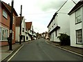
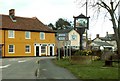

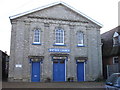
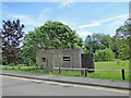
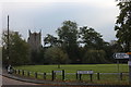
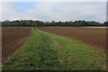
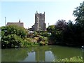
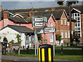
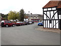
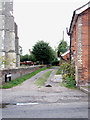
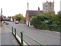
92 photos from this area
Area Information
Key information about the CO8 5HZ including its size, population, and administrative classification.
- Area Type
- Postcode
- Area Size
- 1.6 hectares
- Population
- 1876
- Population Density
- 70 people/km²
House Prices in CO8 5HZ
17
Properties
£514,808
Average Sold Price
£188,000
Lowest Price
£787,500
Highest Price
Showing 17 properties
| Address | Type | Beds | Baths | Last Sale Price | Last Sale Date | |
|---|---|---|---|---|---|---|
| Gildersleve, High Street, Bures St Mary, CO8 5HZ | Semi-detached | 4 | 2 | £505,000 | Oct 2025 | |
| Willow House, High Street, Bures St Mary, CO8 5HZ | Semi-detached | 5 | 2 | £645,000 | Dec 2024 | |
| Crown House, High Street, Bures St Mary, CO8 5HZ | Detached | - | - | £787,500 | Mar 2022 | |
| 1, Tudor Cottages, High Street, Bures St Mary, CO8 5HZ | Terraced | 3 | - | £300,000 | Feb 2022 | |
| 2, Tudor Cottages, High Street, Bures St Mary, CO8 5HZ | Cottage | 3 | 2 | £280,000 | Sep 2021 | |
| Rivendell, High Street, Bures St Mary, CO8 5HZ | Detached | 4 | 3 | £780,000 | Mar 2021 | |
| The Doctors House, High Street, Bures St Mary, CO8 5HZ | Detached | 4 | 2 | £675,000 | Mar 2020 | |
| Orchard House, High Street, Bures St Mary, CO8 5HZ | house | - | - | £702,000 | Apr 2019 | |
| The Old Tannery, High Street, Bures St Mary, CO8 5HZ | house | - | - | £735,000 | Jan 2018 | |
| Speedwell House, High Street, Bures St Mary, CO8 5HZ | Detached | 6 | - | £550,000 | Jun 2017 |
Page 1 of 2
Energy Efficiency in CO8 5HZ
Amenities
Schools
| Rank | School | Type | Entry gender | Ages |
|---|
Explore more schools in this area
Go to Schools tabDemographics
Household Size
Two person
most common
Accommodation Type
Houses
most common
Tenure
73
majority
Ethnic Group
White
most common
Religion
N/A
most common
Household Composition
N/A
most common
Age
47
median
Adults (30-64 years)
most common
Household Deprivation
N/A
with no deprivation
NS-SEC
39
in Lower managerial occupations
Explore more demographic insights in this area
Go to Demographics tabPlanning
Planning Constraints
- Flood RiskPremium
- Ramsar Wetland SitesPremium
- Area of Outstanding Natural BeautyPremium
- Protected Nature ReservePremium
- Protected WoodlandPremium