Area Overview for CO8 5DD
Photos of CO8 5DD
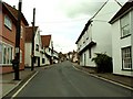
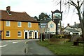
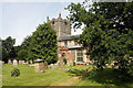
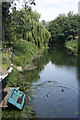
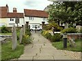
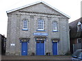
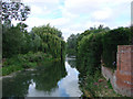
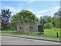
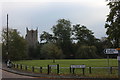
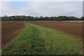
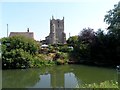
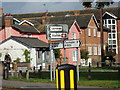
92 photos from this area
Area Information
Key information about the CO8 5DD including its size, population, and administrative classification.
- Area Type
- Postcode
- Area Size
- 1.2 hectares
- Population
- 2212
- Population Density
- 54 people/km²
House Prices in CO8 5DD
15
Properties
£440,583
Average Sold Price
£260,000
Lowest Price
£960,000
Highest Price
Showing 15 properties
| Address | Type | Beds | Baths | Last Sale Price | Last Sale Date | |
|---|---|---|---|---|---|---|
| 9 Station Hill, Bures Hamlet, CO8 5DD | Detached | 3 | 1 | £375,000 | Aug 2025 | |
| 16 Station Hill, Bures Hamlet, CO8 5DD | house | 4 | 2 | £960,000 | Aug 2025 | |
| Constable House, Station Hill, Bures Hamlet, CO8 5DD | Semi-detached | 2 | 2 | £295,000 | Dec 2021 | |
| 11 Station Hill, Bures Hamlet, CO8 5DD | house | 3 | 2 | £385,000 | Jun 2021 | |
| Stour Valley House, Station Hill, Bures Hamlet, CO8 5DD | Semi-detached | 3 | 2 | £385,000 | Jun 2021 | |
| Gainsborough House, Station Hill, Bures Hamlet, CO8 5DD | Bungalow | - | - | £306,000 | Feb 2021 | |
| 3 Station Hill, Bures Hamlet, CO8 5DD | Detached | 3 | 2 | £455,000 | Mar 2020 | |
| The Old Workshop, 20 Station Hill, Bures Hamlet, CO8 5DD | Detached | 4 | 2 | £575,000 | Oct 2018 | |
| Hopewell House, 13 Station Hill, Bures Hamlet, CO8 5DD | house | - | - | £390,000 | Sep 2010 | |
| 15 Station Hill, Bures Hamlet, CO8 5DD | Detached | 4 | 2 | £280,000 | Apr 2008 |
Page 1 of 2
Energy Efficiency in CO8 5DD
Amenities
Schools
| Rank | School | Type | Entry gender | Ages |
|---|
Explore more schools in this area
Go to Schools tabDemographics
Household Size
Two person
most common
Accommodation Type
Houses
most common
Tenure
80
majority
Ethnic Group
White
most common
Religion
N/A
most common
Household Composition
N/A
most common
Age
47
median
Adults (30-64 years)
most common
Household Deprivation
N/A
with no deprivation
NS-SEC
40
in Lower managerial occupations
Explore more demographic insights in this area
Go to Demographics tabPlanning
Planning Constraints
- Flood RiskPremium
- Ramsar Wetland SitesPremium
- Area of Outstanding Natural BeautyPremium
- Protected Nature ReservePremium
- Protected WoodlandPremium