Area Overview for CO7 8SW
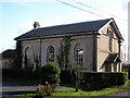
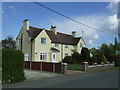
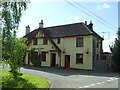
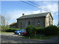
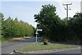
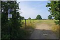
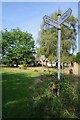
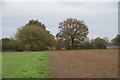
Photos of CO7 8SW

Area Information
CO7 8SW is a small residential postcode area in the village of Little Bentley, Tendring district, Essex. With a population of 1,701 and a low density of 63 people per square kilometre, it retains a quiet, village-like character. The area sits on elevated ground near the Holland Brook, a feature that shaped its early Saxon settlement. Historical roots run deep, with the parish church housing medieval timber beams and 16th-century artefacts. Today, residents benefit from proximity to nearby towns and a mix of practical amenities. The area’s charm lies in its blend of historical heritage and modern convenience, from local shops to rail links. While the broader parish of Little Bentley had a 2021 census population of 294, CO7 8SW reflects a broader residential cluster, offering a balance of seclusion and accessibility. Living here means navigating a tight-knit community with a focus on stability, supported by nearby schools, transport, and the natural surroundings of the Essex countryside.
- Area Type
- Postcode
- Area Size
- Not available
- Population
- 1701
- Population Density
- 63 people/km²
The property market in CO7 8SW is characterised by high home ownership (81%) and a predominance of houses. This suggests a market skewed towards owner-occupied properties rather than rentals, which is typical of rural and semi-rural areas. The focus on houses rather than flats or apartments aligns with the area’s low density and village-like setting. For buyers, this means limited availability of rental properties and a housing stock that prioritises family-friendly, standalone homes. The small size of the postcode area means the immediate surroundings may offer more options, but buyers should consider nearby towns for broader choices. The market’s stability is reinforced by the area’s low flood risk and proximity to essential amenities, making it attractive to those seeking a balance between rural living and practicality.
House Prices in CO7 8SW
No properties found in this postcode.
Energy Efficiency in CO7 8SW
The lifestyle in CO7 8SW is shaped by its proximity to local amenities and the village’s historical character. Residents have access to five retail outlets, including Tesco, Budgens Elmstead, and Spar, offering everyday shopping needs. The rail network, with stations like Great Bentley and Mistley, provides easy access to nearby towns, while the Brightlingsea Ferry Landing connects to water-based travel. The area’s low density and village setting mean a slower pace of life, with opportunities to explore historical sites like Little Bentley’s church, which features medieval timber beams and 16th-century artefacts. The mix of practical amenities and heritage sites creates a balanced lifestyle, blending convenience with a sense of place. Local shops and transport links support daily life, while the surrounding countryside offers space for leisure and reflection.
Amenities
Schools
The nearest school to CO7 8SW is Tendring Primary School, which has an Ofsted rating of “good.” As a primary school, it serves the educational needs of local children from early years through to Year 6. The absence of secondary schools in the immediate area means families may need to look further afield for secondary education, though nearby towns likely offer comprehensive options. The “good” rating indicates a school that meets quality standards, with effective teaching and support for student development. For families prioritising strong primary education, Tendring Primary School is a key asset, though secondary schooling would require planning for commuting. The single school type in the vicinity suggests a focus on foundational education, with broader options available in larger centres.
| Rank | School | Type | Entry gender | Ages |
|---|
Explore more schools in this area
Go to Schools tabDemographics
The community in CO7 8SW is predominantly middle-aged, with a median age of 47 and the most common age range being adults aged 30–64. Home ownership is high at 81%, reflecting a stable, long-term resident base. The accommodation type is primarily houses, which aligns with the area’s rural character and lower population density. The predominant ethnic group is White, indicating a homogenous demographic profile. This suggests a community focused on traditional values and long-term residency rather than transient populations. The age distribution implies a mix of families with school-age children and older adults, though specific data on family structures is not provided. The high home ownership rate likely contributes to a sense of permanence, with residents investing in property as a long-term asset.
Household Size
Accommodation Type
Tenure
Ethnic Group
Religion
Household Composition
Age
Household Deprivation
NS-SEC
Explore more demographic insights in this area
Go to Demographics tabPlanning
Planning Constraints
- Flood RiskPremium
- Ramsar Wetland SitesPremium
- Area of Outstanding Natural BeautyPremium
- Protected Nature ReservePremium
- Protected WoodlandPremium