Area Overview for CO7 8SH
Photos of CO7 8SH
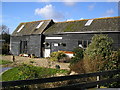
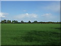
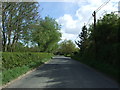
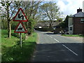
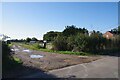
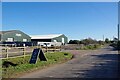

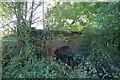
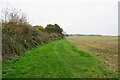
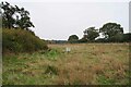

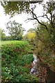
13 photos from this area
Area Information
Key information about the CO7 8SH including its size, population, and administrative classification.
- Area Type
- Postcode
- Area Size
- 51.6 hectares
- Population
- 1701
- Population Density
- 63 people/km²
House Prices in CO7 8SH
24
Properties
£365,958
Average Sold Price
£144,000
Lowest Price
£795,000
Highest Price
Showing 24 properties
| Address | Type | Beds | Baths | Last Sale Price | Last Sale Date | |
|---|---|---|---|---|---|---|
| Sycamore House, Tendring Road, Little Bentley, CO7 8SH | house | - | - | £795,000 | Jan 2022 | |
| Brick Cottage, Tendring Road, Little Bentley, CO7 8SH | Semi-detached | 3 | - | £370,000 | Sep 2021 | |
| Lemon Cottage, Tendring Road, Little Bentley, CO7 8SH | Detached | 3 | - | £325,000 | Dec 2012 | |
| Mill Green Cottage, Tendring Road, Little Bentley, CO7 8SH | Semi-detached | - | - | £235,000 | Dec 2006 | |
| Bramble Cottage, Tendring Road, Little Bentley, CO7 8SH | Detached | - | - | £326,750 | Jul 2002 | |
| Corner Cottage, Tendring Road, Little Bentley, CO7 8SH | Detached | - | - | £144,000 | Aug 1995 | |
| 1, New Cottages, Tendring Road, Little Bentley, CO7 8SH | Semi-detached | 3 | 1 | - | - | |
| Old Oaks Farm, Tendring Road, Little Bentley, CO7 8SH | house | - | - | - | - | |
| Office At, Pump Farm, Tendring Road, Little Bentley, CO7 8SH | warehouse | - | - | - | - | |
| Unit 4, Pump Farm, Tendring Road, Little Bentley, CO7 8SH | Industrial | - | - | - | - |
Page 1 of 3
Energy Efficiency in CO7 8SH
Amenities
Schools
| Rank | School | Type | Entry gender | Ages |
|---|
Explore more schools in this area
Go to Schools tabDemographics
Household Size
Two person
most common
Accommodation Type
Houses
most common
Tenure
81
majority
Ethnic Group
White
most common
Religion
N/A
most common
Household Composition
N/A
most common
Age
47
median
Adults (30-64 years)
most common
Household Deprivation
N/A
with no deprivation
NS-SEC
37
in Lower managerial occupations
Explore more demographic insights in this area
Go to Demographics tabPlanning
Planning Constraints
- Flood RiskPremium
- Ramsar Wetland SitesPremium
- Area of Outstanding Natural BeautyPremium
- Protected Nature ReservePremium
- Protected WoodlandPremium