Area Overview for CO7 8FN
Photos of CO7 8FN
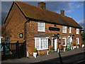
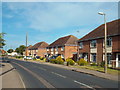
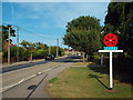
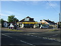
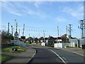


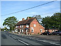
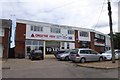
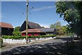
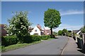
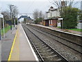
18 photos from this area
Area Information
Key information about the CO7 8FN including its size, population, and administrative classification.
- Area Type
- Postcode
- Area Size
- 1.0 hectares
- Population
- 2464
- Population Density
- 363 people/km²
House Prices in CO7 8FN
25
Properties
£323,426
Average Sold Price
£235,995
Lowest Price
£425,000
Highest Price
Showing 25 properties
| Address | Type | Beds | Baths | Last Sale Price | Last Sale Date | |
|---|---|---|---|---|---|---|
| 16 Woodford Walk, Alresford, CO7 8FN | Detached | 4 | 2 | £425,000 | Mar 2025 | |
| 31 Woodford Walk, Alresford, CO7 8FN | Semi-detached | 3 | 1 | £310,000 | Nov 2024 | |
| 4 Woodford Walk, Alresford, CO7 8FN | Retail | 3 | 2 | £340,000 | Oct 2022 | |
| 35 Woodford Walk, Alresford, CO7 8FN | Detached | - | - | £409,000 | Dec 2020 | |
| 29 Woodford Walk, Alresford, CO7 8FN | house | - | - | £273,995 | Oct 2020 | |
| 12 Woodford Walk, Alresford, CO7 8FN | house | - | - | £269,995 | Jul 2020 | |
| 8 Woodford Walk, Alresford, CO7 8FN | Semi-detached | 2 | - | £235,995 | Jun 2020 | |
| 23 Woodford Walk, Alresford, CO7 8FN | Detached | 2 | 1 | - | - | |
| 33 Woodford Walk, Alresford, CO7 8FN | Detached | 3 | 2 | - | - | |
| 25 Woodford Walk, Alresford, CO7 8FN | Detached | 4 | 2 | - | - |
Page 1 of 3
Energy Efficiency in CO7 8FN
Amenities
Schools
| Rank | School | Type | Entry gender | Ages |
|---|
Explore more schools in this area
Go to Schools tabDemographics
Household Size
Two person
most common
Accommodation Type
Houses
most common
Tenure
87
majority
Ethnic Group
White
most common
Religion
N/A
most common
Household Composition
N/A
most common
Age
47
median
Adults (30-64 years)
most common
Household Deprivation
N/A
with no deprivation
NS-SEC
32
in Lower managerial occupations
Explore more demographic insights in this area
Go to Demographics tabPlanning
Planning Constraints
- Flood RiskPremium
- Ramsar Wetland SitesPremium
- Area of Outstanding Natural BeautyPremium
- Protected Nature ReservePremium
- Protected WoodlandPremium