Area Overview for CO7 8DD
Photos of CO7 8DD

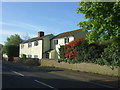
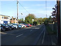
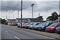
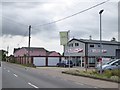


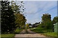
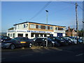

13 photos from this area
Area Information
Key information about the CO7 8DD including its size, population, and administrative classification.
- Area Type
- Postcode
- Area Size
- 30.4 hectares
- Population
- 1541
- Population Density
- 60 people/km²
House Prices in CO7 8DD
15
Properties
£248,812
Average Sold Price
£169,995
Lowest Price
£327,500
Highest Price
Showing 15 properties
| Address | Type | Beds | Baths | Last Sale Price | Last Sale Date | |
|---|---|---|---|---|---|---|
| Cottingale Cottage, Colchester Main Road, Alresford, CO7 8DD | Semi-detached | 2 | 1 | £285,000 | Dec 2024 | |
| Oakwood Cottage, Colchester Main Road, Alresford, CO7 8DD | Detached | 2 | 1 | £285,000 | Nov 2022 | |
| Europa, Colchester Main Road, Alresford, CO7 8DD | Detached | 5 | 3 | £250,000 | Mar 2022 | |
| Primrose Cottage, Colchester Main Road, Alresford, CO7 8DD | Cottage | 2 | 1 | £268,000 | Nov 2019 | |
| Lee Oak, Colchester Main Road, Alresford, CO7 8DD | Detached | 5 | 3 | £327,500 | Apr 2019 | |
| Whitehouse, Colchester Main Road, Alresford, CO7 8DD | house | - | - | £175,000 | Dec 2017 | |
| Fairview, Colchester Main Road, Alresford, CO7 8DD | Detached | 3 | - | £230,000 | Aug 2005 | |
| Heath House, Colchester Main Road, Alresford, CO7 8DD | Detached | 4 | 2 | £169,995 | Jul 1999 | |
| Ferleigh, 21 Colchester Main Road, Alresford, CO7 8DD | Detached | 3 | 1 | - | - | |
| Former Rose And Crown, Colchester Main Road, Alresford, CO7 8DD | Land | - | - | - | - |
Page 1 of 2
Energy Efficiency in CO7 8DD
Amenities
Schools
| Rank | School | Type | Entry gender | Ages |
|---|
Explore more schools in this area
Go to Schools tabDemographics
Household Size
Two person
most common
Accommodation Type
Houses
most common
Tenure
85
majority
Ethnic Group
White
most common
Religion
N/A
most common
Household Composition
N/A
most common
Age
47
median
Adults (30-64 years)
most common
Household Deprivation
N/A
with no deprivation
NS-SEC
33
in Lower managerial occupations
Explore more demographic insights in this area
Go to Demographics tabPlanning
Planning Constraints
- Flood RiskPremium
- Ramsar Wetland SitesPremium
- Area of Outstanding Natural BeautyPremium
- Protected Nature ReservePremium
- Protected WoodlandPremium