Area Overview for CO7 7WR
Photos of CO7 7WR


Area Information
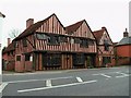
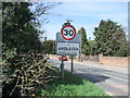
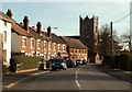
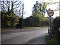
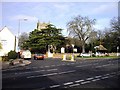
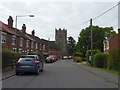
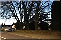
CO7 7WR, a small postcode area in Essex, encompasses the village of Ardleigh, a rural parish with a population of 1375 and a low density of 83 people per square kilometre. Nestled 4 miles northeast of Colchester, Ardleigh retains its medieval character, with a nucleated village core surrounded by agricultural land and hamlets like Ardleigh Heath. The area’s charm lies in its historical roots, including a Bronze Age cemetery and 14th-century St Mary’s Church. Daily life here balances rural tranquillity with practical connectivity. Residents benefit from nearby railway stations at Manningtree, Hythe, and Colchester, while the A137 road links to Ipswich. The village’s dispersed layout features traditional barns, cottages, and farmsteads, creating a distinct, low-density living environment. With a median age of 47, the community leans towards adults in their 30s to 60s, reflecting a stable, family-oriented demographic. For those seeking a peaceful yet accessible lifestyle, CO7 7WR offers a blend of historical heritage and modern convenience.
- Area Type
- Postcode
- Area Size
- Not available
- Population
- 1375
- Population Density
- 83 people/km²
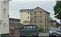
CO7 7WR is characterised by a high rate of home ownership (76%), with houses forming the primary accommodation type. This suggests a community of settled residents rather than a rental market, making it less attractive for investors seeking short-term returns. The small area’s housing stock is likely limited, given its rural nature and low population density. For buyers, this means competition for properties may be lower, but availability of new builds or larger homes could be constrained. The predominance of houses aligns with the village’s traditional layout, offering spacious, private living in a low-density setting. However, the small size of the postcode area means buyers should consider nearby settlements for broader property options.
House Prices in CO7 7WR
No properties found in this postcode.
Energy Efficiency in CO7 7WR
The lifestyle in CO7 7WR is defined by its rural character and practical amenities. Nearby, five retail outlets include Tesco Colchester and the East of England Co-operative, offering everyday shopping. The village’s proximity to Ardleigh Reservoir and historical sites like St Mary’s Church provides opportunities for leisure and cultural engagement. The A137 road and rail stations at Manningtree and Colchester ensure access to larger towns for dining, entertainment, and services. The low population density fosters a quiet, community-focused environment, though residents must travel for specialist amenities. The mix of traditional architecture and accessible transport creates a balanced lifestyle, blending rural charm with modern convenience.
Amenities
Schools
CO7 7WR is served by two primary schools: St Mary’s Church of England Voluntary Controlled Primary School, Ardleigh, and Ardleigh St Mary’s Church of England Primary Academy. Both are primary institutions, catering to younger children in the village. The presence of two schools suggests a focus on early education, though no secondary schools are listed in the area. Families with children may need to look beyond CO7 7WR for secondary education, as the data does not mention local secondary schools. The availability of primary schools supports the area’s appeal to families, though proximity to larger towns like Colchester would be necessary for comprehensive schooling.
| Rank | School | Type | Entry gender | Ages |
|---|
Explore more schools in this area
Go to Schools tabDemographics
The population of CO7 7WR is predominantly adults aged 30–64, with a median age of 47. Home ownership is high at 76%, indicating a community of long-term residents rather than transient renters. The area’s accommodation is largely houses, reflecting a preference for private, detached living. The predominant ethnic group is White, with no specific data on other demographics. The low population density of 83 people per square kilometre suggests a spread-out, rural settlement pattern. This demographic profile implies a mature, stable community with established families and fewer young professionals. The absence of significant deprivation data means quality of life is likely supported by strong local services, though the limited population size may mean fewer amenities compared to larger towns.
Household Size
Accommodation Type
Tenure
Ethnic Group
Religion
Household Composition
Age
Household Deprivation
NS-SEC
Explore more demographic insights in this area
Go to Demographics tabPlanning
Planning Constraints
- Flood RiskPremium
- Ramsar Wetland SitesPremium
- Area of Outstanding Natural BeautyPremium
- Protected Nature ReservePremium
- Protected WoodlandPremium