Area Overview for CO7 7SE
Photos of CO7 7SE
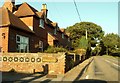
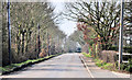
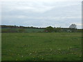
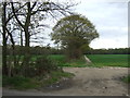
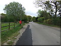
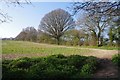
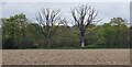
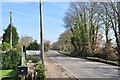
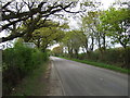
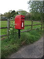
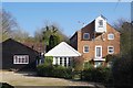
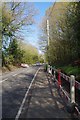
12 photos from this area
Area Information
Key information about the CO7 7SE including its size, population, and administrative classification.
- Area Type
- Postcode
- Area Size
- 28.0 hectares
- Population
- 1375
- Population Density
- 83 people/km²
House Prices in CO7 7SE
16
Properties
£650,714
Average Sold Price
£335,000
Lowest Price
£1,250,000
Highest Price
Showing 16 properties
| Address | Type | Beds | Baths | Last Sale Price | Last Sale Date | |
|---|---|---|---|---|---|---|
| Meadow View Cottage, Bromley Road, Ardleigh, CO7 7SE | Detached | 4 | 2 | £420,000 | Sep 2024 | |
| 38 Bromley Road, Ardleigh, CO7 7SE | Semi-detached | 3 | 1 | £335,000 | Aug 2023 | |
| Old Mission, 39 Bromley Road, Ardleigh, CO7 7SE | Detached | 5 | 3 | £540,000 | Sep 2019 | |
| Fairview, Bromley Road, Ardleigh, CO7 7SE | Detached | 4 | 3 | £800,000 | Apr 2019 | |
| Valleyview, Bromley Road, Ardleigh, CO7 7SE | house | - | - | £810,000 | Mar 2019 | |
| Oak View Cottage, Bromley Road, Ardleigh, CO7 7SE | house | - | - | £400,000 | Feb 2019 | |
| Greystones, Bromley Road, Ardleigh, CO7 7SE | house | - | - | £1,250,000 | Sep 2010 | |
| The Barn, Broomhangings Farm, Bromley Road, Ardleigh, CO7 7SE | Detached | 5 | - | - | - | |
| Crockleford Grange, Bromley Road, Ardleigh, CO7 7SE | Detached | 5 | - | - | - | |
| Hillcrest House, Bromley Road, Ardleigh, CO7 7SE | Detached | 5 | - | - | - |
Page 1 of 2
Energy Efficiency in CO7 7SE
Amenities
Schools
| Rank | School | Type | Entry gender | Ages |
|---|
Explore more schools in this area
Go to Schools tabDemographics
Household Size
Two person
most common
Accommodation Type
Houses
most common
Tenure
76
majority
Ethnic Group
White
most common
Religion
N/A
most common
Household Composition
N/A
most common
Age
47
median
Adults (30-64 years)
most common
Household Deprivation
N/A
with no deprivation
NS-SEC
36
in Lower managerial occupations
Explore more demographic insights in this area
Go to Demographics tabPlanning
Planning Constraints
- Flood RiskPremium
- Ramsar Wetland SitesPremium
- Area of Outstanding Natural BeautyPremium
- Protected Nature ReservePremium
- Protected WoodlandPremium