Area Overview for CO7 7QB
Photos of CO7 7QB
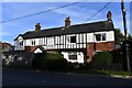
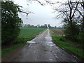
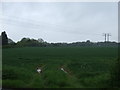
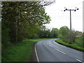
10 photos from this area
Area Information
Key information about the CO7 7QB including its size, population, and administrative classification.
- Area Type
- Postcode
- Area Size
- 19.4 hectares
- Population
- 1638
- Population Density
- 146 people/km²
House Prices in CO7 7QB
21
Properties
£623,577
Average Sold Price
£148,000
Lowest Price
£1,350,000
Highest Price
Showing 21 properties
| Address | Type | Beds | Baths | Last Sale Price | Last Sale Date | |
|---|---|---|---|---|---|---|
| Oak Meadow, Dedham Road, Ardleigh, CO7 7QB | Bungalow | 3 | 3 | £750,000 | Jun 2025 | |
| Heath House, Dedham Road, Ardleigh, CO7 7QB | Detached | 4 | 2 | £1,130,000 | Dec 2022 | |
| Meadow Cottage, Dedham Road, Ardleigh, CO7 7QB | Detached | 5 | 2 | £1,085,000 | Jul 2022 | |
| Red House, Dedham Road, Ardleigh, CO7 7QB | Semi-detached | 4 | - | £575,000 | Jun 2021 | |
| Ingleside, Dedham Road, Ardleigh, CO7 7QB | Semi-detached | 3 | 1 | £315,500 | Oct 2017 | |
| Old House, Dedham Road, Ardleigh, CO7 7QB | house | - | - | £630,000 | Dec 2016 | |
| Stourwood, Dedham Road, Ardleigh, CO7 7QB | house | - | - | £433,000 | May 2015 | |
| Westmead, Dedham Road, Ardleigh, CO7 7QB | Detached | 4 | - | £550,000 | Mar 2015 | |
| Criffel, Dedham Road, Ardleigh, CO7 7QB | Semi-detached | 3 | - | £320,000 | Nov 2013 | |
| Ardleigh Grange, Dedham Road, Ardleigh, CO7 7QB | Detached | 3 | - | £1,350,000 | Jul 2010 |
Page 1 of 3
Energy Efficiency in CO7 7QB
Amenities
Schools
| Rank | School | Type | Entry gender | Ages |
|---|
Explore more schools in this area
Go to Schools tabDemographics
Household Size
Family (3-5 people)
most common
Accommodation Type
Houses
most common
Tenure
85
majority
Ethnic Group
White
most common
Religion
N/A
most common
Household Composition
N/A
most common
Age
47
median
Adults (30-64 years)
most common
Household Deprivation
N/A
with no deprivation
NS-SEC
40
in Lower managerial occupations
Explore more demographic insights in this area
Go to Demographics tabPlanning
Planning Constraints
- Flood RiskPremium
- Ramsar Wetland SitesPremium
- Area of Outstanding Natural BeautyPremium
- Protected Nature ReservePremium
- Protected WoodlandPremium