Area Overview for CO7 7EG
Photos of CO7 7EG
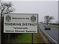
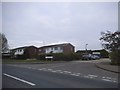
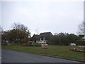
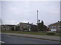
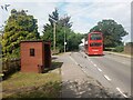

12 photos from this area
Area Information
Key information about the CO7 7EG including its size, population, and administrative classification.
- Area Type
- Postcode
- Area Size
- 7391 m²
- Population
- 1541
- Population Density
- 60 people/km²
House Prices in CO7 7EG
10
Properties
£190,357
Average Sold Price
£64,500
Lowest Price
£280,000
Highest Price
Showing 10 properties
| Address | Type | Beds | Baths | Last Sale Price | Last Sale Date | |
|---|---|---|---|---|---|---|
| Wadena, Colchester Road, Elmstead, CO7 7EG | house | 3 | - | £220,000 | May 2014 | |
| Matapos, Colchester Road, Elmstead, CO7 7EG | Detached | 4 | 3 | £245,000 | May 2013 | |
| Dulverton, Colchester Road, Elmstead, CO7 7EG | house | - | - | £280,000 | May 2010 | |
| Lanwyn, 6 Colchester Road, Elmstead, CO7 7EG | Detached | - | - | £250,000 | Feb 2004 | |
| Brooklands, Colchester Road, Elmstead, CO7 7EG | Detached | 4 | 2 | £190,000 | May 2002 | |
| Birches, Colchester Road, Elmstead, CO7 7EG | Bungalow | 2 | 2 | £64,500 | Dec 1996 | |
| Rembrandt, Colchester Road, Elmstead, CO7 7EG | Detached | - | - | £83,000 | Aug 1996 | |
| Felbridge, Colchester Road, Elmstead, CO7 7EG | Bungalow | 3 | 1 | - | - | |
| Orchards, Colchester Road, Elmstead, CO7 7EG | Detached | - | - | - | - | |
| Barnside, Colchester Road, Elmstead, CO7 7EG | Detached | - | - | - | - |
Energy Efficiency in CO7 7EG
Amenities
Schools
| Rank | School | Type | Entry gender | Ages |
|---|
Explore more schools in this area
Go to Schools tabDemographics
Household Size
Two person
most common
Accommodation Type
Houses
most common
Tenure
85
majority
Ethnic Group
White
most common
Religion
N/A
most common
Household Composition
N/A
most common
Age
47
median
Adults (30-64 years)
most common
Household Deprivation
N/A
with no deprivation
NS-SEC
33
in Lower managerial occupations
Explore more demographic insights in this area
Go to Demographics tabPlanning
Planning Constraints
- Flood RiskPremium
- Ramsar Wetland SitesPremium
- Area of Outstanding Natural BeautyPremium
- Protected Nature ReservePremium
- Protected WoodlandPremium