Area Overview for CO7 7DE
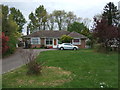
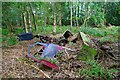
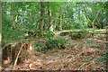
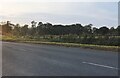
Photos of CO7 7DE

Area Information
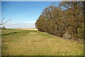
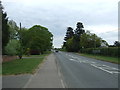
CO7 7DE is a small, tightly knit residential cluster in Essex, encompassing parts of Elmstead and its surrounding villages. With a population of 1,541 spread across 65.3 hectares, the area maintains a low density of 60 people per square kilometre, offering a quiet, semi-rural lifestyle. Nestled near Colchester, Wivenhoe, and Alresford, it benefits from proximity to major roads like the A120 and A133, ensuring easy access to nearby towns. The area’s charm lies in its blend of historic and modern elements: the parish church of St Anne and St Lawrence dates to the 14th century, while nearby attractions like Bourne Mill and Beth Chatto Gardens cater to both locals and visitors. Daily life here is characterised by a slower pace, with community ties strengthened by the small population and limited development. Residents enjoy a balance of rural tranquillity and practical connectivity, making it appealing to those seeking a peaceful yet accessible location.
- Area Type
- Postcode
- Area Size
- 65.3 hectares
- Population
- 1541
- Population Density
- 60 people/km²
The property market in CO7 7DE is dominated by owner-occupied homes, with 85% of residences owned by their occupants. This suggests a stable market with limited rental activity, likely due to the area’s small size and focus on family homes. The accommodation type is predominantly houses, which are well-suited to the demographic of middle-aged adults and families. For buyers, this means a limited but consistent selection of properties, often with traditional layouts and garden spaces. The small area size means competition for available homes can be fierce, particularly for those seeking specific features like proximity to schools or transport links. However, the high home ownership rate indicates a reliable, long-term investment potential for those prioritising security and community stability.
House Prices in CO7 7DE
Showing 2 properties
| Address | Type | Beds | Baths | Last Sale Price | Last Sale Date | |
|---|---|---|---|---|---|---|
| Caravan At, Bottles Hall, Clacton Road, Elmstead, CO7 7DE | Mobile Home | - | - | - | - | |
| Bottles Hall, Clacton Road, Elmstead, CO7 7DE | Detached | - | - | - | - |
Energy Efficiency in CO7 7DE
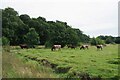
Daily life in CO7 7DE is supported by a range of nearby amenities. Five retail outlets, including Budgens Elmstead and the East of England Co-operative, offer essential shopping and convenience. The area’s proximity to rail stations and ferry landings facilitates access to broader leisure and employment opportunities. While specific parks or recreational spaces are not detailed in the data, the nearby Beth Chatto Gardens and Bourne Mill suggest green spaces for relaxation. The small-scale nature of the area means amenities are closely clustered, fostering a sense of community. Residents benefit from a balance of practicality and charm, with shops, transport, and natural attractions all within reach.
Amenities
Schools
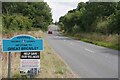
Residents of CO7 7DE have access to two notable schools. St George’s Church of England Primary School in Great Bromley is a state-funded institution with a ‘good’ Ofsted rating, offering a reliable foundation for young children. Nearby, the independent Focus School - Colchester Primary Campus provides an alternative with a more specialised curriculum. The mix of school types ensures families can choose between public and private education, though the independent option may come with higher costs. Both schools are within practical reach, supporting families seeking quality education without long commutes. This diversity in schooling options reflects the area’s appeal to households prioritising educational opportunities for their children.
| Rank | School | Type | Entry gender | Ages |
|---|
Explore more schools in this area
Go to Schools tabDemographics
The population of CO7 7DE skews towards middle-aged adults, with a median age of 47 and the majority (30–64 years) in the prime working and family-raising years. Home ownership is high at 85%, reflecting a stable, long-term resident base. The area is predominantly composed of houses rather than flats, aligning with the demographics of established families. The predominant ethnic group is White, and while specific diversity data is not provided, the community appears homogenous. The low population density of 60 people per square kilometre suggests a spread-out, less congested living environment. This profile indicates a mature, settled community with strong local ties, though it may lack the diversity seen in larger urban centres.
Household Size
Accommodation Type
Tenure
Ethnic Group
Religion
Household Composition
Age
Household Deprivation
NS-SEC
Explore more demographic insights in this area
Go to Demographics tabPlanning
Planning Constraints
- Flood RiskPremium
- Ramsar Wetland SitesPremium
- Area of Outstanding Natural BeautyPremium
- Protected Nature ReservePremium
- Protected WoodlandPremium