Area Overview for CO7 7AW
Photos of CO7 7AW
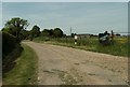
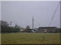
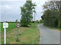
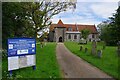
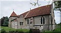
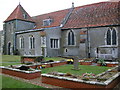
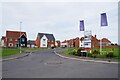
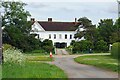
9 photos from this area
Area Information
Key information about the CO7 7AW including its size, population, and administrative classification.
- Area Type
- Postcode
- Area Size
- 10.6 hectares
- Population
- 1541
- Population Density
- 60 people/km²
House Prices in CO7 7AW
23
Properties
£430,464
Average Sold Price
£78,500
Lowest Price
£830,000
Highest Price
Showing 23 properties
| Address | Type | Beds | Baths | Last Sale Price | Last Sale Date | |
|---|---|---|---|---|---|---|
| Wishing Well, 35 Church Road, Elmstead, CO7 7AW | Detached | 5 | 3 | £830,000 | Jul 2023 | |
| 53A Church Road, Elmstead, CO7 7AW | Retail | 5 | 3 | £697,000 | Mar 2022 | |
| Elmscot, 37 Church Road, Elmstead, CO7 7AW | Detached | 6 | 4 | £685,000 | Apr 2021 | |
| 41 Church Road, Elmstead, CO7 7AW | Semi-detached | 4 | - | £425,000 | Feb 2021 | |
| 34 Church Road, Elmstead, CO7 7AW | Detached | 3 | 2 | £375,000 | Sep 2019 | |
| 39 Church Road, Elmstead, CO7 7AW | Semi-detached | 4 | 2 | £405,000 | Jul 2016 | |
| 49A Church Road, Elmstead, CO7 7AW | Detached | 4 | 3 | £410,000 | Jul 2011 | |
| 51A Church Road, Elmstead, CO7 7AW | Detached | 5 | - | £390,000 | Jun 2011 | |
| 53 Church Road, Elmstead, CO7 7AW | house | 4 | - | £386,000 | May 2011 | |
| 51 Church Road, Elmstead, CO7 7AW | Detached | 5 | - | £420,000 | Sep 2008 |
Page 1 of 3
Energy Efficiency in CO7 7AW
Amenities
Schools
| Rank | School | Type | Entry gender | Ages |
|---|
Explore more schools in this area
Go to Schools tabDemographics
Household Size
Two person
most common
Accommodation Type
Houses
most common
Tenure
85
majority
Ethnic Group
White
most common
Religion
N/A
most common
Household Composition
N/A
most common
Age
47
median
Adults (30-64 years)
most common
Household Deprivation
N/A
with no deprivation
NS-SEC
33
in Lower managerial occupations
Explore more demographic insights in this area
Go to Demographics tabPlanning
Planning Constraints
- Flood RiskPremium
- Ramsar Wetland SitesPremium
- Area of Outstanding Natural BeautyPremium
- Protected Nature ReservePremium
- Protected WoodlandPremium