Area Overview for CO7 6QQ
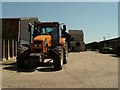
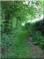
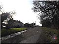
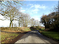
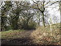
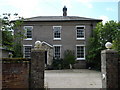
Photos of CO7 6QQ
Area Information
CO7 6QQ is a small, residential postcode area in England, covering 1.2 km² with a population of 1172 people. Its low density—67 residents per square kilometre—suggests a quiet, spread-out community rather than a bustling town. Situated in Wenham Magna, a civil parish in Suffolk, it includes hamlets like Gipsy Row and Vauxhall. The area is steeped in history, notably as the birthplace of Matthew Hopkins, the 17th-century witchfinder general. Nearby, St John’s Church, a Grade II* listed building, and Wenham Place, a 16th-century red-brick home, reflect the region’s architectural heritage. Daily life here balances rural tranquillity with practical connectivity. Residents benefit from proximity to rail stations and a mix of local shops, while the area’s low population density ensures a sense of space and privacy. For those seeking a blend of historical interest and modern convenience, CO7 6QQ offers a distinct character shaped by its small-scale community and rich local history.
- Area Type
- Postcode
- Area Size
- 1.2 km²
- Population
- 1172
- Population Density
- 67 people/km²
CO7 6QQ is primarily an owner-occupied area, with 83% of homes owned by residents rather than rented. The housing stock consists almost entirely of houses, not flats, which is typical of rural or semi-rural regions. Given the area’s small size—just 1.2 km²—the property market is limited in scale, with a finite number of homes available. This scarcity may make the area appealing to buyers seeking a quiet, low-density environment but could also lead to competition for properties. The prevalence of houses suggests a focus on family homes, with potential for larger gardens or outdoor spaces. For buyers, the challenge lies in the limited availability of new builds, meaning most properties are established homes. Proximity to nearby towns and rail links may also influence property values, as residents can access urban amenities without living in a larger settlement.
House Prices in CO7 6QQ
Showing 2 properties
| Address | Type | Beds | Baths | Last Sale Price | Last Sale Date | |
|---|---|---|---|---|---|---|
| Vauxhall Farm, Vauxhall, Wenham Magna, CO7 6QQ | Retail | 3 | 3 | - | - | |
| The Grain Barn, Vauxhall Farm, Vauxhall, Wenham Magna, CO7 6QQ | Industrial | - | - | - | - |
Energy Efficiency in CO7 6QQ
Residents of CO7 6QQ have access to a modest selection of nearby amenities. Five retail outlets, including East of England Co-operative Co and Spar, provide basic shopping needs within practical reach. The area’s rail stations—Manningtree, Ipswich, and Entrance—offer connections to larger towns, enabling access to more extensive leisure, dining, and cultural options. While the immediate vicinity lacks large supermarkets or entertainment venues, the proximity to rail networks compensates by allowing residents to enjoy urban amenities without living in a larger settlement. The area’s low population density and historical sites, such as St John’s Church, contribute to a quiet, characterful lifestyle. However, those prioritising a wide range of local amenities may find the selection limited, requiring regular trips to nearby towns.
Amenities
Schools
The nearest school to CO7 6QQ is Stratford St Mary Primary School, which holds a ‘good’ Ofsted rating. As a primary school, it serves children aged 4 to 11, making it a key consideration for families with young children. The presence of a single primary school suggests that secondary education options may be located in nearby towns, such as Manningtree or Ipswich, which are accessible via rail. The ‘good’ rating indicates that the school meets national standards in teaching quality and student outcomes, though parents may need to supplement with additional educational resources or extracurricular activities. For families prioritising a strong local school, Stratford St Mary Primary offers a reliable foundation, but the lack of secondary schools within the area means planning for further education is essential.
| Rank | School | Type | Entry gender | Ages |
|---|
Explore more schools in this area
Go to Schools tabDemographics
The population of CO7 6QQ has a median age of 47, with the majority of residents aged between 30 and 64. This suggests a community of middle-aged adults, likely including families and professionals. Home ownership is high at 83%, indicating a stable, long-term resident base. The area is predominantly composed of houses, not flats, reflecting a traditional, family-oriented housing stock. The predominant ethnic group is White, which aligns with broader regional demographics. With a population density of 67 people per square kilometre, the area avoids the congestion of larger towns, offering a more relaxed lifestyle. This demographic profile implies a community focused on stability and continuity, where local amenities and services cater to the needs of established households rather than transient populations.
Household Size
Accommodation Type
Tenure
Ethnic Group
Religion
Household Composition
Age
Household Deprivation
NS-SEC
Explore more demographic insights in this area
Go to Demographics tabPlanning
Planning Constraints
- Flood RiskPremium
- Ramsar Wetland SitesPremium
- Area of Outstanding Natural BeautyPremium
- Protected Nature ReservePremium
- Protected WoodlandPremium