Area Overview for CO7 6LZ
Photos of CO7 6LZ


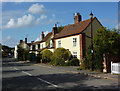
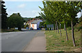
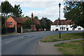

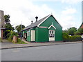
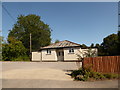
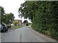
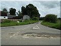
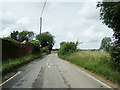

74 photos from this area
Area Information
Key information about the CO7 6LZ including its size, population, and administrative classification.
- Area Type
- Postcode
- Area Size
- 14.1 hectares
- Population
- 1172
- Population Density
- 67 people/km²
House Prices in CO7 6LZ
13
Properties
£381,333
Average Sold Price
£128,000
Lowest Price
£640,000
Highest Price
Showing 13 properties
| Address | Type | Beds | Baths | Last Sale Price | Last Sale Date | |
|---|---|---|---|---|---|---|
| 95 School Lane, Stratford St Mary, CO7 6LZ | Detached | 3 | 2 | £420,000 | Oct 2023 | |
| Magnolia House, School Lane, Stratford St Mary, CO7 6LZ | house | - | - | £530,000 | Jan 2022 | |
| The Old Rectory, School Lane, Stratford St Mary, CO7 6LZ | Detached | 4 | 4 | £640,000 | Dec 2017 | |
| Church View Cottage, School Lane, Stratford St Mary, CO7 6LZ | Detached | 4 | 2 | £325,000 | Dec 2010 | |
| Cheriton, 93 School Lane, Stratford St Mary, CO7 6LZ | Retail | 4 | 2 | £245,000 | Nov 2006 | |
| 94 School Lane, Stratford St Mary, CO7 6LZ | house | - | - | £128,000 | Mar 1999 | |
| Everlong, School Lane, Stratford St Mary, CO7 6LZ | Detached | 4 | 2 | - | - | |
| Glebe House, School Lane, Stratford St Mary, CO7 6LZ | house | 5 | - | - | - | |
| The Coach House, School Lane, Stratford St Mary, CO7 6LZ | Detached | - | - | - | - | |
| Tennis 61M From Glebe House, School Lane 25M From School Lane, School Lane, Stratford St Mary, CO7 6LZ | Leisure | - | - | - | - |
Page 1 of 2
Energy Efficiency in CO7 6LZ
Amenities
Schools
| Rank | School | Type | Entry gender | Ages |
|---|
Explore more schools in this area
Go to Schools tabDemographics
Household Size
Two person
most common
Accommodation Type
Houses
most common
Tenure
83
majority
Ethnic Group
White
most common
Religion
N/A
most common
Household Composition
N/A
most common
Age
47
median
Adults (30-64 years)
most common
Household Deprivation
N/A
with no deprivation
NS-SEC
49
in Lower managerial occupations
Explore more demographic insights in this area
Go to Demographics tabPlanning
Planning Constraints
- Flood RiskPremium
- Ramsar Wetland SitesPremium
- Area of Outstanding Natural BeautyPremium
- Protected Nature ReservePremium
- Protected WoodlandPremium