Area Overview for CO7 6HA
Photos of CO7 6HA
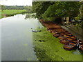
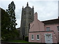
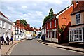

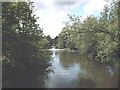

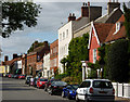
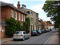
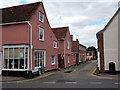
100 photos from this area
Area Information
Key information about the CO7 6HA including its size, population, and administrative classification.
- Area Type
- Postcode
- Area Size
- 2330 m²
- Population
- 1657
- Population Density
- 233 people/km²
House Prices in CO7 6HA
10
Properties
£808,333
Average Sold Price
£400,000
Lowest Price
£1,200,000
Highest Price
Showing 10 properties
| Address | Type | Beds | Baths | Last Sale Price | Last Sale Date | |
|---|---|---|---|---|---|---|
| Dairy House, High Street, Dedham, CO7 6HA | Detached | 4 | 2 | £1,200,000 | Jun 2024 | |
| Farthings, High Street, Dedham, CO7 6HA | house | 3 | 2 | £825,000 | Jul 2023 | |
| Piper House, High Street, Dedham, CO7 6HA | Terraced | - | - | £400,000 | Jun 2010 | |
| The Old Post Office, High Street, Dedham, CO7 6HA | Semi-detached | 5 | 3 | - | - | |
| Darbys, High Street, Dedham, CO7 6HA | Terraced | 2 | 1 | - | - | |
| Organic Financial Solutions Ltd, The Dedham Bookshop, High Street, Dedham, CO7 6HA | retail_financial | - | - | - | - | |
| Old Exchange House, High Street, Dedham, CO7 6HA | undefined | - | - | - | - | |
| Snaffles, London House, High Street, Dedham, CO7 6HA | Maisonette | - | - | - | - | |
| Tegfan, High Street, Dedham, CO7 6HA | house | - | - | - | - | |
| Bank Flat, London House, High Street, Dedham, CO7 6HA | Maisonette | 1 | 1 | - | - |
Energy Efficiency in CO7 6HA
Amenities
Schools
| Rank | School | Type | Entry gender | Ages |
|---|
Explore more schools in this area
Go to Schools tabDemographics
Household Size
Two person
most common
Accommodation Type
Houses
most common
Tenure
76
majority
Ethnic Group
White
most common
Religion
N/A
most common
Household Composition
N/A
most common
Age
47
median
Adults (30-64 years)
most common
Household Deprivation
N/A
with no deprivation
NS-SEC
45
in Lower managerial occupations
Explore more demographic insights in this area
Go to Demographics tabPlanning
Planning Constraints
- Flood RiskPremium
- Ramsar Wetland SitesPremium
- Area of Outstanding Natural BeautyPremium
- Protected Nature ReservePremium
- Protected WoodlandPremium