Area Overview for CO7 6DT
Photos of CO7 6DT
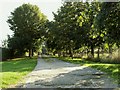
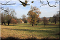
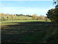
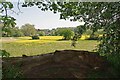
22 photos from this area
Area Information
Key information about the CO7 6DT including its size, population, and administrative classification.
- Area Type
- Postcode
- Area Size
- 30.3 hectares
- Population
- 1657
- Population Density
- 233 people/km²
House Prices in CO7 6DT
10
Properties
£939,998
Average Sold Price
£600,000
Lowest Price
£1,600,000
Highest Price
Showing 10 properties
| Address | Type | Beds | Baths | Last Sale Price | Last Sale Date | |
|---|---|---|---|---|---|---|
| Meadowbrook, Grove Hill, Dedham, CO7 6DT | Retail | 5 | 2 | £1,600,000 | Jun 2022 | |
| The Cottage, Grove Hill, Dedham, CO7 6DT | Detached | 5 | - | £619,995 | Oct 2015 | |
| Shelley Glebe Barn, Grove Hill, Dedham, CO7 6DT | Semi-detached | 3 | 3 | £600,000 | Apr 2007 | |
| Brook Farm House, Grove Hill, Dedham, CO7 6DT | Detached | 4 | 3 | - | - | |
| Brookside, Grove Hill, Dedham, CO7 6DT | Semi-detached | - | - | - | - | |
| The Grove, Grove Hill, Dedham, CO7 6DT | house | 8 | - | - | - | |
| Shelley Glebe Farm, Grove Hill, Dedham, CO7 6DT | Farm | - | - | - | - | |
| Freemans Farm, Grove Hill, Dedham, CO7 6DT | Farm | - | - | - | - | |
| Brookside Cottage, Grove Hill, Dedham, CO7 6DT | Flat | - | - | - | - | |
| Coach House, Grove Hill, Dedham, CO7 6DT | Detached | - | - | - | - |
Energy Efficiency in CO7 6DT
Amenities
Schools
| Rank | School | Type | Entry gender | Ages |
|---|
Explore more schools in this area
Go to Schools tabDemographics
Household Size
Two person
most common
Accommodation Type
Houses
most common
Tenure
76
majority
Ethnic Group
White
most common
Religion
N/A
most common
Household Composition
N/A
most common
Age
47
median
Adults (30-64 years)
most common
Household Deprivation
N/A
with no deprivation
NS-SEC
45
in Lower managerial occupations
Explore more demographic insights in this area
Go to Demographics tabPlanning
Planning Constraints
- Flood RiskPremium
- Ramsar Wetland SitesPremium
- Area of Outstanding Natural BeautyPremium
- Protected Nature ReservePremium
- Protected WoodlandPremium