Area Overview for CO7 0UA
Photos of CO7 0UA
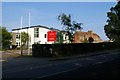
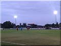
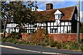
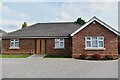
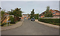
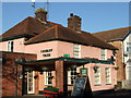
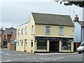
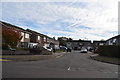
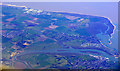
9 photos from this area
Area Information
Key information about the CO7 0UA including its size, population, and administrative classification.
- Area Type
- Postcode
- Area Size
- 1.2 hectares
- Population
- 1478
- Population Density
- 260 people/km²
House Prices in CO7 0UA
19
Properties
£233,727
Average Sold Price
£49,000
Lowest Price
£375,000
Highest Price
Showing 19 properties
| Address | Type | Beds | Baths | Last Sale Price | Last Sale Date | |
|---|---|---|---|---|---|---|
| 18 Chestnut Way, Brightlingsea, CO7 0UA | house | - | - | £330,000 | Mar 2021 | |
| 16 Chestnut Way, Brightlingsea, CO7 0UA | house | - | - | £375,000 | Dec 2020 | |
| 12 Chestnut Way, Brightlingsea, CO7 0UA | house | 4 | - | £357,000 | Jun 2020 | |
| 1 Chestnut Way, Brightlingsea, CO7 0UA | Semi-detached | 3 | 1 | £267,500 | Jan 2019 | |
| 3 Chestnut Way, Brightlingsea, CO7 0UA | Semi-detached | 4 | 1 | £230,000 | Aug 2016 | |
| 13 Chestnut Way, Brightlingsea, CO7 0UA | Semi-detached | 3 | 1 | £250,000 | Aug 2016 | |
| Pippins, 2A Chestnut Way, Brightlingsea, CO7 0UA | Detached | 4 | - | £315,000 | May 2016 | |
| 14 Chestnut Way, Brightlingsea, CO7 0UA | Detached | - | - | £196,000 | Oct 2002 | |
| The Willows, 2B Chestnut Way, Brightlingsea, CO7 0UA | Semi-detached | - | - | £115,000 | Nov 2000 | |
| 10 Chestnut Way, Brightlingsea, CO7 0UA | Detached | - | - | £86,500 | Jul 1998 |
Page 1 of 2
Energy Efficiency in CO7 0UA
Amenities
Schools
| Rank | School | Type | Entry gender | Ages |
|---|
Explore more schools in this area
Go to Schools tabDemographics
Household Size
Two person
most common
Accommodation Type
Houses
most common
Tenure
81
majority
Ethnic Group
White
most common
Religion
N/A
most common
Household Composition
N/A
most common
Age
47
median
Adults (30-64 years)
most common
Household Deprivation
N/A
with no deprivation
NS-SEC
30
in Lower managerial occupations
Explore more demographic insights in this area
Go to Demographics tabPlanning
Planning Constraints
- Flood RiskPremium
- Ramsar Wetland SitesPremium
- Area of Outstanding Natural BeautyPremium
- Protected Nature ReservePremium
- Protected WoodlandPremium