Area Overview for CO7 0RW
Photos of CO7 0RW
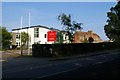

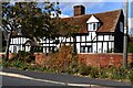
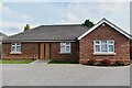
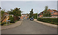
9 photos from this area
Area Information
Key information about the CO7 0RW including its size, population, and administrative classification.
- Area Type
- Postcode
- Area Size
- 1.8 hectares
- Population
- 1478
- Population Density
- 260 people/km²
House Prices in CO7 0RW
20
Properties
£221,467
Average Sold Price
£72,500
Lowest Price
£415,000
Highest Price
Showing 20 properties
| Address | Type | Beds | Baths | Last Sale Price | Last Sale Date | |
|---|---|---|---|---|---|---|
| 12 Samsons Road, Brightlingsea, CO7 0RW | Detached | 5 | 2 | £415,000 | Jun 2025 | |
| 1 Samsons Road, Brightlingsea, CO7 0RW | Bungalow | 2 | 1 | £242,000 | Feb 2022 | |
| 15 Samsons Road, Brightlingsea, CO7 0RW | Bungalow | 2 | 1 | £255,000 | Sep 2021 | |
| 16 Samsons Road, Brightlingsea, CO7 0RW | Bungalow | - | - | £245,000 | Jun 2021 | |
| 11 Samsons Road, Brightlingsea, CO7 0RW | Bungalow | 2 | 2 | £328,500 | Dec 2020 | |
| 23 Samsons Road, Brightlingsea, CO7 0RW | Bungalow | 3 | 1 | £230,000 | Sep 2018 | |
| 14 Samsons Road, Brightlingsea, CO7 0RW | Bungalow | 2 | 1 | £275,000 | Mar 2018 | |
| 5 Samsons Road, Brightlingsea, CO7 0RW | Bungalow | - | - | £152,000 | Nov 2017 | |
| 17 Samsons Road, Brightlingsea, CO7 0RW | Bungalow | 2 | - | £165,000 | Aug 2016 | |
| 10 Samsons Road, Brightlingsea, CO7 0RW | Detached | 5 | - | £285,000 | Jun 2015 |
Page 1 of 2
Energy Efficiency in CO7 0RW
Amenities
Schools
| Rank | School | Type | Entry gender | Ages |
|---|
Explore more schools in this area
Go to Schools tabDemographics
Household Size
Two person
most common
Accommodation Type
Houses
most common
Tenure
81
majority
Ethnic Group
White
most common
Religion
N/A
most common
Household Composition
N/A
most common
Age
47
median
Adults (30-64 years)
most common
Household Deprivation
N/A
with no deprivation
NS-SEC
30
in Lower managerial occupations
Explore more demographic insights in this area
Go to Demographics tabPlanning
Planning Constraints
- Flood RiskPremium
- Ramsar Wetland SitesPremium
- Area of Outstanding Natural BeautyPremium
- Protected Nature ReservePremium
- Protected WoodlandPremium