Area Overview for CO7 0QU
Photos of CO7 0QU
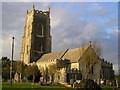
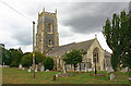
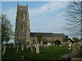
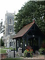
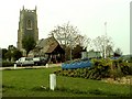

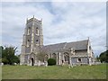
19 photos from this area
Area Information
Key information about the CO7 0QU including its size, population, and administrative classification.
- Area Type
- Postcode
- Area Size
- 7.3 hectares
- Population
- 1478
- Population Density
- 260 people/km²
House Prices in CO7 0QU
14
Properties
£539,225
Average Sold Price
£108,000
Lowest Price
£1,328,572
Highest Price
Showing 14 properties
| Address | Type | Beds | Baths | Last Sale Price | Last Sale Date | |
|---|---|---|---|---|---|---|
| Strangers Corner, Church Road, Brightlingsea, CO7 0QU | Detached | 4 | 3 | £675,000 | Jun 2024 | |
| Greythorpe, Church Road, Brightlingsea, CO7 0QU | Detached | 5 | 4 | £800,000 | Dec 2020 | |
| Futures Care Homes Limited, Futures, 162 Church Road, Brightlingsea, CO7 0QU | hospital_care_home | - | - | £1,328,572 | Feb 2018 | |
| 166 Church Road, Brightlingsea, CO7 0QU | Bungalow | 3 | 2 | £320,000 | Feb 2013 | |
| Woodcroft, Church Road, Brightlingsea, CO7 0QU | Detached | - | - | £420,000 | Dec 2007 | |
| Sarane, Church Road, Brightlingsea, CO7 0QU | Detached | - | - | £123,000 | Aug 2000 | |
| 172 Church Road, Brightlingsea, CO7 0QU | Detached | - | - | £108,000 | Dec 1995 | |
| 176 Church Road, Brightlingsea, CO7 0QU | Bungalow | 3 | 2 | - | - | |
| 168 Church Road, Brightlingsea, CO7 0QU | Detached | - | - | - | - | |
| Jildi, 170 Church Road, Brightlingsea, CO7 0QU | Detached | - | - | - | - |
Page 1 of 2
Energy Efficiency in CO7 0QU
Amenities
Schools
| Rank | School | Type | Entry gender | Ages |
|---|
Explore more schools in this area
Go to Schools tabDemographics
Household Size
Two person
most common
Accommodation Type
Houses
most common
Tenure
81
majority
Ethnic Group
White
most common
Religion
N/A
most common
Household Composition
N/A
most common
Age
47
median
Adults (30-64 years)
most common
Household Deprivation
N/A
with no deprivation
NS-SEC
30
in Lower managerial occupations
Explore more demographic insights in this area
Go to Demographics tabPlanning
Planning Constraints
- Flood RiskPremium
- Ramsar Wetland SitesPremium
- Area of Outstanding Natural BeautyPremium
- Protected Nature ReservePremium
- Protected WoodlandPremium