Area Overview for CO7 0QD
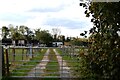
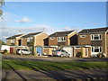
Photos of CO7 0QD
Area Information
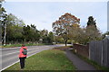
Living in CO7 0QD places you within a specific residential cluster characterised by quiet streets and a strong sense of established community. This small area forms part of the larger Brightlingsea civil parish in Essex, a town defined by its maritime heritage and position on a promontory surrounded by the River Colne. With a population of 1,478 residents, the locality maintains a compact scale where neighbours often know one another. You will find the neighbourhood sits within a region rich in history, having been an island until the 16th century and supporting centuries of trade and fishing. The coastal setting provides a distinct atmosphere compared to the wider Eastern English Region, with daily life shaped by the proximity to the river and local marshes. Residents enjoy a tight-knit environment where the architectural layout supports a residential focus rather than commercial sprawl. The area combines the convenience of modern living with the historical depth of a place recorded in the Domesday Book. Those seeking homes here are choosing a setting that balances isolation with accessibility to necessary services, including several railway stations and ferry landings a short practical distance away.
- Area Type
- Postcode
- Area Size
- Not available
- Population
- 1478
- Population Density
- 260 people/km²
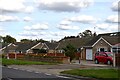
The property market in CO7 0QD is defined by owner-occupation, with 81% of residents having purchased their homes. This statistic reveals a market where security of tenure is the norm rather than the exception. The accommodation type consists entirely of houses, meaning there are no flats or maisonettes within this specific postcode cluster. This preference for detached or semi-detached homes aligns with the historical development of Brightlingsea as a coastal civil parish. Buyers approaching this area should expect to compete in an established market rather than a new-build sector. The high ownership rate suggests that many properties have been in the same families for generations, potentially affecting price elasticity and renovation budgets. The housing stock reflects the maritime history of the region, with structures designed to withstand coastal conditions. For those looking to rent, the 19% non-ownership rate indicates a smaller but present segment of the market, though finding a rental here would be the exception rather than the rule. The area appeals primarily to buyers rather than landlords seeking yield properties.
House Prices in CO7 0QD
No properties found in this postcode.
Energy Efficiency in CO7 0QD
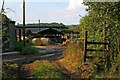
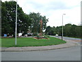
Daily life in CO7 0QD revolves around a mix of local retail, coastal leisure, and rail connectivity. Within practical reach of your home, you can find five notable retail venues, including locations for the East of England Co-operative and the superstore Tesco Brightlingsea. These shopping options meet essential grocery and daily needs without requiring a long drive. The area also boasts significant maritime connectivity with three ferry landings available. The Brightlingsea Ferry Landing stands out as a key location, connecting to nearby ports and supporting the town's historic trade links. Five railway stations serve the local community, placing Great Bentley and Wivenhoe within easy commuting distance. Beyond commerce and transport, the lifestyle is anchored by the natural environment of the River Colne and surrounding marshes. Residents can walk to the ancient parish church of All Saints, which dates back to the 13th century, offering a quiet space for recreation. The proximity to the sea provides distinct seasonal activities and views that define the local character. You will find a balanced environment where historical interest overlays modern convenience.
Amenities
Schools
Families considering homes in CO7 0QD have access to three distinct educational institutions operating under various governance structures. Colne Community School and College appears twice in the local registry, listed as both a primary provider and an academy. A third institution sharing the name Colne Community School operates specifically as an academy with an Ofsted rating of good. The presence of both primary and academy entities within the immediate vicinity suggests a layered educational catchment area. You will find that the area supports children at different developmental stages through these specific providers. Learning in close proximity to Brightlingsea ensures that daily travel times remain short and manageable. The mix of traditional primary schooling and academy status offers varied educational philosophies for parents to evaluate. While data on enrollment numbers or exam results is not included in the current overview, the availability of a rated academy provides a clear metric for assessing educational quality. Parents looking at schools near CO7 0QD can rely on the Ofsted grading as a primary indicator of institutional performance.
| Rank | School | Type | Entry gender | Ages |
|---|
Explore more schools in this area
Go to Schools tabDemographics
The community in CO7 0QD is dominated by adults, with the most common age range falling between 30 and 64 years. The median age of 47 years indicates the neighbourhood attracts mature buyers rather than young families or students. A significant strength for this area is the high level of home ownership, which stands at 81%. This figure demonstrates that the vast majority of households have purchased their properties through the housing market rather than renting. The accommodation type is exclusively houses, ensuring a consistent residential character throughout the postcode. The predominant ethnic group is White, reflecting the historic settlement patterns of the region. With a population density of 260 people per square kilometre, the area feels spacious yet connected. The age profile suggests a stable, settled population that has likely contributed to the high property ownership rates. There are no indications of transient populations or student enclaves within this specific cluster. The demographic profile aligns well with a family-friendly or retirement-oriented environment where residents tend to stay put for extended periods. This stability often translates into a consistent local vote bank and long-term engagement with community services.
Household Size
Accommodation Type
Tenure
Ethnic Group
Religion
Household Composition
Age
Household Deprivation
NS-SEC
Explore more demographic insights in this area
Go to Demographics tabPlanning
Planning Constraints
- Flood RiskPremium
- Ramsar Wetland SitesPremium
- Area of Outstanding Natural BeautyPremium
- Protected Nature ReservePremium
- Protected WoodlandPremium