Area Overview for CO7 0LE
Photos of CO7 0LE
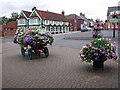
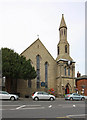
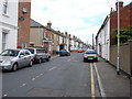
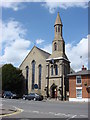
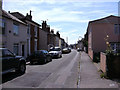
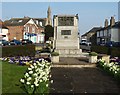
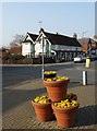

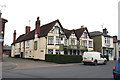

100 photos from this area
Area Information
Key information about the CO7 0LE including its size, population, and administrative classification.
- Area Type
- Postcode
- Area Size
- 1.8 hectares
- Population
- 1684
- Population Density
- 1804 people/km²
House Prices in CO7 0LE
16
Properties
£205,400
Average Sold Price
£53,000
Lowest Price
£305,000
Highest Price
Showing 16 properties
| Address | Type | Beds | Baths | Last Sale Price | Last Sale Date | |
|---|---|---|---|---|---|---|
| 16 Birch Close, Brightlingsea, CO7 0LE | Bungalow | 2 | 1 | £290,500 | Mar 2025 | |
| 4 Birch Close, Brightlingsea, CO7 0LE | Semi-detached | 3 | 1 | £305,000 | Feb 2025 | |
| 12 Birch Close, Brightlingsea, CO7 0LE | Bungalow | 2 | 1 | £272,500 | Apr 2024 | |
| 13 Birch Close, Brightlingsea, CO7 0LE | Bungalow | - | - | £220,000 | Oct 2020 | |
| 15 Birch Close, Brightlingsea, CO7 0LE | Bungalow | 2 | 1 | £240,000 | Mar 2017 | |
| 5 Birch Close, Brightlingsea, CO7 0LE | Semi-detached | 5 | - | £229,995 | Jul 2012 | |
| 1 Birch Close, Brightlingsea, CO7 0LE | Semi-detached | - | - | £197,000 | May 2007 | |
| 7 Birch Close, Brightlingsea, CO7 0LE | Semi-detached | - | - | £192,000 | Mar 2007 | |
| 14 Birch Close, Brightlingsea, CO7 0LE | Semi-detached | - | - | £54,000 | Oct 1999 | |
| 2 Birch Close, Brightlingsea, CO7 0LE | house | - | - | £53,000 | Aug 1997 |
Page 1 of 2
Energy Efficiency in CO7 0LE
Amenities
Schools
| Rank | School | Type | Entry gender | Ages |
|---|
Explore more schools in this area
Go to Schools tabDemographics
Household Size
Two person
most common
Accommodation Type
Houses
most common
Tenure
79
majority
Ethnic Group
White
most common
Religion
N/A
most common
Household Composition
N/A
most common
Age
47
median
Adults (30-64 years)
most common
Household Deprivation
N/A
with no deprivation
NS-SEC
28
in Lower managerial occupations
Explore more demographic insights in this area
Go to Demographics tabPlanning
Planning Constraints
- Flood RiskPremium
- Ramsar Wetland SitesPremium
- Area of Outstanding Natural BeautyPremium
- Protected Nature ReservePremium
- Protected WoodlandPremium