Area Overview for CO7 0AA
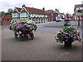
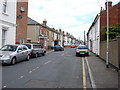
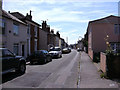
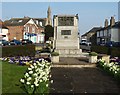
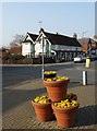
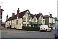
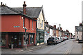
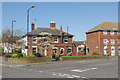
Photos of CO7 0AA


Area Information
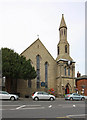
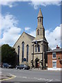
CO7 0AA is a small, tightly packed postcode area in Essex, encompassing the coastal town of Brightlingsea. With a population of 2,057 spread across just 477 square metres, it is one of the most densely populated areas in England. The town’s history is deeply tied to its maritime heritage, with a natural harbour that has supported trade and fishing for centuries. Today, the area retains a distinct character shaped by its proximity to the River Colne and its surrounding marshes. Residents benefit from a mix of practical amenities, including multiple ferry landings and railway stations, which connect the area to nearby towns. The community is predominantly composed of adults aged 30–64, with a median age of 47, suggesting a stable, mature demographic. Living here means navigating a compact, high-density environment where historical landmarks like All Saints’ Church and the Cinque Port Wreck House coexist with modern retail options. The area’s small size means that daily life revolves around close-knit interactions and easy access to coastal and inland resources.
- Area Type
- Postcode
- Area Size
- 477 m²
- Population
- Not available
- Population Density
- Not available
The property market in CO7 0AA is characterised by a 59% home ownership rate, with houses making up the majority of accommodation types. This suggests a primarily owner-occupied market, though the small area size and high population density may limit the availability of properties. The compact nature of the postcode means that housing stock is likely to be limited, with competition for available homes. Given the historical significance of the area, properties may retain unique architectural features, such as those found in the Cinque Port Wreck House. However, the lack of data on property prices or recent developments means that buyers should consider the area’s small footprint and potential constraints on expansion. For those seeking homes, the focus is on existing residences rather than new builds, with a need to balance proximity to amenities against the challenges of limited space.
House Prices in CO7 0AA
Showing 1 properties
| Address | Type | Beds | Baths | Last Sale Price | Last Sale Date | |
|---|---|---|---|---|---|---|
| Royal Mail, Brightlingsea Delivery Office, 42 Victoria Place, Brightlingsea, CO7 0AA | commercial | - | - | - | - |
Energy Efficiency in CO7 0AA
Living in CO7 0AA offers a blend of practical amenities and historical charm. The area has five retail outlets, including Tesco Brightlingsea and Spar, providing everyday shopping needs. Three ferry landings, such as Brightlingsea Ferry Landing, connect residents to nearby waterways, while five railway stations ensure easy access to surrounding regions. The coastal location means that daily life is influenced by the River Colne and its marshes, with historical sites like All Saints’ Church and the Cinque Port Wreck House adding cultural depth. The compact nature of the area means that amenities are within practical reach, though the high density may limit green spaces. Residents can enjoy a mix of maritime and inland activities, with the ferry services and rail links facilitating both leisure and commuting. The presence of multiple retail options and transport hubs suggests a functional, community-focused lifestyle.
Amenities
Schools
| Rank | School | Type | Entry gender | Ages |
|---|
Explore more schools in this area
Go to Schools tabDemographics
The population of CO7 0AA is 2,057, with a population density of 4,311,630 people per square kilometre—among the highest in the UK. The median age is 47, and the majority of residents fall within the 30–64 age range, indicating a mature, stable community. Home ownership rates stand at 59%, with houses being the predominant type of accommodation. The predominant ethnic group is White, reflecting the area’s historical and cultural continuity. The high population density, combined with the small area size, means that residents live in close proximity to one another, fostering a sense of community but also necessitating efficient use of space. This demographic profile suggests a population focused on established careers and family life, with limited presence of younger or older age groups. The data does not indicate significant deprivation levels, but the high density could imply challenges in housing availability and infrastructure strain.
Household Size
Accommodation Type
Tenure
Ethnic Group
Religion
Household Composition
Age
Household Deprivation
NS-SEC
Explore more demographic insights in this area
Go to Demographics tabPlanning
Planning Constraints
- Flood RiskPremium
- Ramsar Wetland SitesPremium
- Area of Outstanding Natural BeautyPremium
- Protected Nature ReservePremium
- Protected WoodlandPremium