Area Overview for CO6 4RX
Photos of CO6 4RX


Area Information
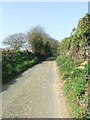
Living in CO6 4RX means becoming part of a small, tightly knit residential cluster in the Babergh district of Suffolk, near the Essex border. With a population of 1,856 and a density of 68 people per square kilometre, the area feels intimate, with homes spread across a landscape shaped by history and nature. Stoke-by-Nayland, the village at the heart of this postcode, is steeped in medieval heritage, from its 15th-century church to timber-framed buildings that line its lanes. Daily life here blends rural tranquillity with accessible amenities, such as nearby rail links to Colchester and a selection of local shops. The area’s proximity to the River Stour and surrounding green spaces offers a peaceful backdrop, while its small size ensures a sense of familiarity. For those seeking a community with a balance of tradition and practicality, CO6 4RX provides a base that is both rooted in history and connected to modern essentials.
- Area Type
- Postcode
- Area Size
- Not available
- Population
- 1856
- Population Density
- 68 people/km²
The property market in CO6 4RX is characterised by a high rate of home ownership (72%) and a predominance of houses rather than flats or apartments. This reflects the area’s rural nature and small-scale residential cluster, where larger homes are more common. The limited number of properties in this postcode means the market is unlikely to be highly competitive, but buyers should consider the proximity to larger towns like Colchester for more extensive options. The focus on owner-occupied homes suggests a community of long-term residents, which may influence property values and availability. For those seeking a home in this area, the emphasis on houses and low density means a careful assessment of local amenities and transport links is essential to ensure the property meets both current and future needs.
House Prices in CO6 4RX
No properties found in this postcode.
Energy Efficiency in CO6 4RX
The lifestyle in CO6 4RX is shaped by its proximity to a mix of retail and transport hubs. Within reach are notable venues such as M&S Colchester Connect BP, East of England Co-operative Co, and Sainsburys Colchester, offering everyday shopping needs. The two nearby railway stations—Bures and Colchester—enhance mobility, connecting residents to broader networks. While the area’s charm lies in its historical character, the practical amenities ensure convenience. The presence of schools, shops, and transport links means daily life balances local tradition with modern essentials. For those who enjoy a slower pace, the village’s heritage sites and green spaces provide a counterpoint to the ease of access to larger urban centres.
Amenities
Schools
CO6 4RX is served by a range of primary schools, including Nayland Primary School and Stoke-by-Nayland Church of England Voluntary Controlled Primary School, both of which hold a ‘good’ Ofsted rating. Stoke-by-Nayland Middle School and Stoke-by-Nayland Church of England Primary School also cater to younger children, providing multiple options for families. For those seeking independent education, OneSchool Global UK Colchester Campus is nearby, offering a different approach to learning. The mix of state and independent schools ensures flexibility for parents, whether they prioritise traditional schooling or alternative educational models. This variety supports families at different stages of their children’s education, from early years to secondary schooling, and reflects the area’s commitment to educational provision.
| Rank | School | Type | Entry gender | Ages |
|---|
Explore more schools in this area
Go to Schools tabDemographics
The population of CO6 4RX is predominantly middle-aged, with a median age of 47 and the most common age range being 30–64 years. This suggests a stable community of families and long-term residents. Home ownership is high, at 72%, indicating a strong preference for owning property rather than renting. The accommodation type is largely houses, which aligns with the area’s rural character and lower density. The predominant ethnic group is White, reflecting the broader demographic trends in this part of Suffolk. While specific data on deprivation is not provided, the high home ownership rate and age profile suggest a relatively affluent, established population. This demographic profile may appeal to buyers seeking a settled, family-oriented environment with a focus on long-term residency.
Household Size
Accommodation Type
Tenure
Ethnic Group
Religion
Household Composition
Age
Household Deprivation
NS-SEC
Explore more demographic insights in this area
Go to Demographics tabPlanning
Planning Constraints
- Flood RiskPremium
- Ramsar Wetland SitesPremium
- Area of Outstanding Natural BeautyPremium
- Protected Nature ReservePremium
- Protected WoodlandPremium