Area Overview for CO6 4PU
Photos of CO6 4PU

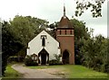
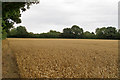
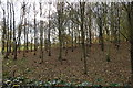
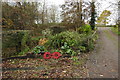
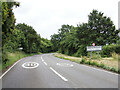
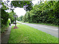
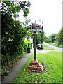
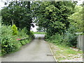
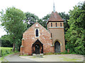
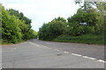
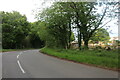
21 photos from this area
Area Information
Key information about the CO6 4PU including its size, population, and administrative classification.
- Area Type
- Postcode
- Area Size
- 71.1 hectares
- Population
- 1795
- Population Density
- 101 people/km²
House Prices in CO6 4PU
9
Properties
£654,625
Average Sold Price
£93,500
Lowest Price
£1,350,000
Highest Price
Showing 9 properties
| Address | Type | Beds | Baths | Last Sale Price | Last Sale Date | |
|---|---|---|---|---|---|---|
| Woodbarn Farm, Nayland Road, Leavenheath, CO6 4PU | house | - | - | £975,000 | Mar 2022 | |
| Keebles House, Nayland Road, Leavenheath, CO6 4PU | Detached | 6 | 4 | £1,350,000 | Jun 2021 | |
| Sunset House, Nayland Road, Leavenheath, CO6 4PU | house | - | - | £93,500 | Feb 2017 | |
| Keebles Cottage, Nayland Road, Leavenheath, CO6 4PU | house | 3 | - | £200,000 | Jul 2016 | |
| South Keebles, Nayland Road, Leavenheath, CO6 4PU | Detached | 5 | 3 | - | - | |
| Tennis 58M From Leaven Hall, Nayland Road 14M From Unnamed Road, Access Road To Leaden Hall From A 134, Leavenheath, CO6 4PU | Leisure | - | - | - | - | |
| Wood View, Nayland Road, Leavenheath, CO6 4PU | house | - | - | - | - | |
| Leaven Hall, Nayland Road, Leavenheath, CO6 4PU | house | - | - | - | - | |
| Leaven Hall Cottage, Nayland Road, Leavenheath, CO6 4PU | Bungalow | - | - | - | - |
Energy Efficiency in CO6 4PU
Amenities
Schools
| Rank | School | Type | Entry gender | Ages |
|---|
Explore more schools in this area
Go to Schools tabDemographics
Household Size
Two person
most common
Accommodation Type
Houses
most common
Tenure
87
majority
Ethnic Group
White
most common
Religion
N/A
most common
Household Composition
N/A
most common
Age
47
median
Adults (30-64 years)
most common
Household Deprivation
N/A
with no deprivation
NS-SEC
44
in Lower managerial occupations
Explore more demographic insights in this area
Go to Demographics tabPlanning
Planning Constraints
- Flood RiskPremium
- Ramsar Wetland SitesPremium
- Area of Outstanding Natural BeautyPremium
- Protected Nature ReservePremium
- Protected WoodlandPremium