Area Overview for CO6 4JF
Photos of CO6 4JF
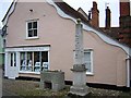
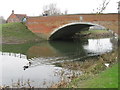

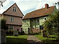


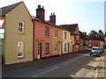
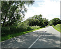


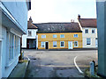

100 photos from this area
Area Information
Key information about the CO6 4JF including its size, population, and administrative classification.
- Area Type
- Postcode
- Area Size
- 8929 m²
- Population
- 1856
- Population Density
- 68 people/km²
House Prices in CO6 4JF
14
Properties
£294,600
Average Sold Price
£200,000
Lowest Price
£475,000
Highest Price
Showing 14 properties
| Address | Type | Beds | Baths | Last Sale Price | Last Sale Date | |
|---|---|---|---|---|---|---|
| Matthew Douglas Ltd, 4, Church Mews, High Street, Nayland With Wissington, CO6 4JF | Terraced | 3 | 1 | £300,000 | Dec 2018 | |
| 2, Church Mews, High Street, Nayland With Wissington, CO6 4JF | Terraced | 2 | 1 | £248,000 | Sep 2013 | |
| 1, Church Mews, High Street, Nayland With Wissington, CO6 4JF | Semi-detached | 2 | - | £250,000 | Oct 2012 | |
| 14 High Street, Nayland With Wissington, CO6 4JF | house | - | - | £200,000 | Aug 2007 | |
| 8 High Street, Nayland With Wissington, CO6 4JF | house | - | - | £475,000 | Dec 2002 | |
| 5, Church Mews, High Street, Nayland With Wissington, CO6 4JF | Semi-detached | 3 | 2 | - | - | |
| 15-17 High Street, Nayland With Wissington, CO6 4JF | Terraced | - | - | - | - | |
| The Old Guildhall, 13 High Street, Nayland With Wissington, CO6 4JF | Terraced | - | - | - | - | |
| 18 High Street, Nayland With Wissington, CO6 4JF | retail_financial | - | - | - | - | |
| 6 High Street, Nayland With Wissington, CO6 4JF | house | - | - | - | - |
Page 1 of 2
Energy Efficiency in CO6 4JF
Amenities
Schools
| Rank | School | Type | Entry gender | Ages |
|---|
Explore more schools in this area
Go to Schools tabDemographics
Household Size
Two person
most common
Accommodation Type
Houses
most common
Tenure
72
majority
Ethnic Group
White
most common
Religion
N/A
most common
Household Composition
N/A
most common
Age
47
median
Adults (30-64 years)
most common
Household Deprivation
N/A
with no deprivation
NS-SEC
41
in Lower managerial occupations
Explore more demographic insights in this area
Go to Demographics tabPlanning
Planning Constraints
- Flood RiskPremium
- Ramsar Wetland SitesPremium
- Area of Outstanding Natural BeautyPremium
- Protected Nature ReservePremium
- Protected WoodlandPremium