Area Overview for CO6 4EU
Photos of CO6 4EU
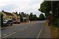
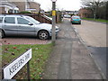
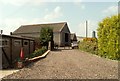
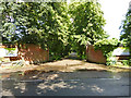
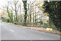

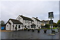
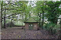
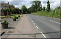

17 photos from this area
Area Information
Key information about the CO6 4EU including its size, population, and administrative classification.
- Area Type
- Postcode
- Area Size
- 2.6 hectares
- Population
- 2022
- Population Density
- 846 people/km²
House Prices in CO6 4EU
46
Properties
£308,120
Average Sold Price
£13,630
Lowest Price
£615,000
Highest Price
Showing 46 properties
| Address | Type | Beds | Baths | Last Sale Price | Last Sale Date | |
|---|---|---|---|---|---|---|
| 10 Brick Kiln Lane, Great Horkesley, CO6 4EU | Terraced | 2 | 1 | £238,000 | Aug 2025 | |
| Daisy Cottage, 12 Brick Kiln Lane, Great Horkesley, CO6 4EU | house | 2 | 1 | £277,000 | Feb 2024 | |
| Hillside, Brick Kiln Lane, Great Horkesley, CO6 4EU | Semi-detached | 3 | 2 | £425,000 | Feb 2024 | |
| 5 Brick Kiln Lane, Great Horkesley, CO6 4EU | Semi-detached | 4 | 2 | £615,000 | Nov 2022 | |
| 11 Brick Kiln Lane, Great Horkesley, CO6 4EU | Terraced | 2 | 1 | £207,000 | Jun 2021 | |
| 8 Brick Kiln Lane, Great Horkesley, CO6 4EU | house | - | - | £440,000 | Jan 2021 | |
| 4A Brick Kiln Lane, Great Horkesley, CO6 4EU | Detached | 2 | 1 | £275,000 | Sep 2020 | |
| Thatched Cottage, Brick Kiln Lane, Great Horkesley, CO6 4EU | Detached | - | - | £300,000 | Dec 2019 | |
| Hill Top, Brick Kiln Lane, Great Horkesley, CO6 4EU | Detached | 4 | 3 | £472,500 | Dec 2019 | |
| The Beeches, Brick Kiln Lane, Great Horkesley, CO6 4EU | Bungalow | 3 | 2 | £387,500 | Oct 2019 |
Page 1 of 5
Energy Efficiency in CO6 4EU
Amenities
Schools
| Rank | School | Type | Entry gender | Ages |
|---|
Explore more schools in this area
Go to Schools tabDemographics
Household Size
Family (3-5 people)
most common
Accommodation Type
Houses
most common
Tenure
83
majority
Ethnic Group
White
most common
Religion
N/A
most common
Household Composition
N/A
most common
Age
47
median
Adults (30-64 years)
most common
Household Deprivation
N/A
with no deprivation
NS-SEC
40
in Lower managerial occupations
Explore more demographic insights in this area
Go to Demographics tabPlanning
Planning Constraints
- Flood RiskPremium
- Ramsar Wetland SitesPremium
- Area of Outstanding Natural BeautyPremium
- Protected Nature ReservePremium
- Protected WoodlandPremium