Area Overview for CO6 2ST
Photos of CO6 2ST
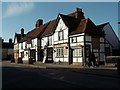
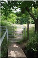
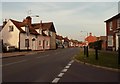
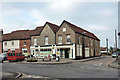
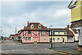
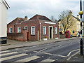
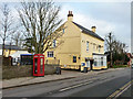
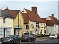
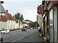
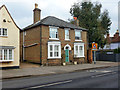
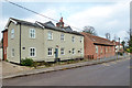
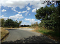
74 photos from this area
Area Information
Key information about the CO6 2ST including its size, population, and administrative classification.
- Area Type
- Postcode
- Area Size
- 4404 m²
- Population
- 1818
- Population Density
- 174 people/km²
House Prices in CO6 2ST
20
Properties
£237,279
Average Sold Price
£145,000
Lowest Price
£330,000
Highest Price
Showing 20 properties
| Address | Type | Beds | Baths | Last Sale Price | Last Sale Date | |
|---|---|---|---|---|---|---|
| 32 Massingham Drive, Earls Colne, CO6 2ST | Semi-detached | 3 | 2 | £325,000 | Apr 2023 | |
| 20 Massingham Drive, Earls Colne, CO6 2ST | house | - | - | £300,000 | Dec 2021 | |
| 4 Massingham Drive, Earls Colne, CO6 2ST | Semi-detached | 3 | 3 | £325,000 | Jul 2017 | |
| 12 Massingham Drive, Earls Colne, CO6 2ST | Semi-detached | 3 | - | £280,000 | Sep 2015 | |
| 18 Massingham Drive, Earls Colne, CO6 2ST | Terraced | 3 | - | £205,000 | Aug 2013 | |
| 10 Massingham Drive, Earls Colne, CO6 2ST | Terraced | 3 | - | £180,000 | Mar 2012 | |
| 16 Massingham Drive, Earls Colne, CO6 2ST | Terraced | 3 | 2 | £200,000 | Nov 2010 | |
| 24 Massingham Drive, Earls Colne, CO6 2ST | house | 4 | 2 | £225,000 | Dec 2009 | |
| 36 Massingham Drive, Earls Colne, CO6 2ST | house | - | - | £270,000 | Oct 2009 | |
| 22 Massingham Drive, Earls Colne, CO6 2ST | Terraced | - | - | £199,995 | Aug 2009 |
Page 1 of 2
Energy Efficiency in CO6 2ST
Amenities
Schools
| Rank | School | Type | Entry gender | Ages |
|---|
Explore more schools in this area
Go to Schools tabDemographics
Household Size
Two person
most common
Accommodation Type
Houses
most common
Tenure
81
majority
Ethnic Group
White
most common
Religion
N/A
most common
Household Composition
N/A
most common
Age
47
median
Adults (30-64 years)
most common
Household Deprivation
N/A
with no deprivation
NS-SEC
38
in Lower managerial occupations
Explore more demographic insights in this area
Go to Demographics tabPlanning
Planning Constraints
- Flood RiskPremium
- Ramsar Wetland SitesPremium
- Area of Outstanding Natural BeautyPremium
- Protected Nature ReservePremium
- Protected WoodlandPremium