Area Overview for CO6 2FG
Photos of CO6 2FG
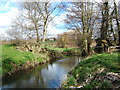
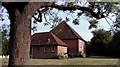
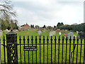
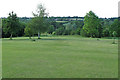

18 photos from this area
Area Information
Key information about the CO6 2FG including its size, population, and administrative classification.
- Area Type
- Postcode
- Area Size
- 6.7 hectares
- Population
- 1862
- Population Density
- 1380 people/km²
House Prices in CO6 2FG
46
Properties
£626,898
Average Sold Price
£323,000
Lowest Price
£779,000
Highest Price
Showing 46 properties
| Address | Type | Beds | Baths | Last Sale Price | Last Sale Date | |
|---|---|---|---|---|---|---|
| 7 Aubrey Close, Earls Colne, CO6 2FG | Retail | 4 | 3 | £750,000 | Sep 2025 | |
| 5 Aubrey Close, Earls Colne, CO6 2FG | Detached | 4 | 3 | £650,000 | Jun 2025 | |
| 8 Aubrey Close, Earls Colne, CO6 2FG | Detached | 4 | 3 | £590,000 | Feb 2025 | |
| Compromise Corner, 42 Aubrey Close, Earls Colne, CO6 2FG | Detached | 5 | 3 | £735,000 | Jan 2025 | |
| 6 Aubrey Close, Earls Colne, CO6 2FG | Detached | 4 | 3 | £610,000 | Sep 2023 | |
| 38 Aubrey Close, Earls Colne, CO6 2FG | Detached | 5 | 3 | £715,000 | May 2023 | |
| 18 Aubrey Close, Earls Colne, CO6 2FG | Detached | 4 | 3 | £779,000 | Apr 2023 | |
| 20 Aubrey Close, Earls Colne, CO6 2FG | house | - | - | £594,950 | Dec 2021 | |
| 16 Aubrey Close, Earls Colne, CO6 2FG | house | - | - | £499,950 | Sep 2021 | |
| 14 Aubrey Close, Earls Colne, CO6 2FG | house | - | - | £499,950 | Sep 2021 |
Page 1 of 5
Energy Efficiency in CO6 2FG
Amenities
Schools
| Rank | School | Type | Entry gender | Ages |
|---|
Explore more schools in this area
Go to Schools tabDemographics
Household Size
Two person
most common
Accommodation Type
Houses
most common
Tenure
52
majority
Ethnic Group
White
most common
Religion
N/A
most common
Household Composition
N/A
most common
Age
47
median
Adults (30-64 years)
most common
Household Deprivation
N/A
with no deprivation
NS-SEC
29
in Lower managerial occupations
Explore more demographic insights in this area
Go to Demographics tabPlanning
Planning Constraints
- Flood RiskPremium
- Ramsar Wetland SitesPremium
- Area of Outstanding Natural BeautyPremium
- Protected Nature ReservePremium
- Protected WoodlandPremium