Area Overview for CO6 1TW
Photos of CO6 1TW
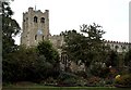
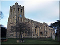
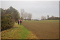
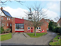
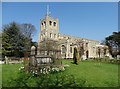
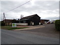
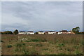
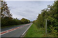
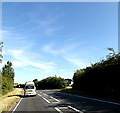
23 photos from this area
Area Information
Key information about the CO6 1TW including its size, population, and administrative classification.
- Area Type
- Postcode
- Area Size
- 3.3 hectares
- Population
- 1784
- Population Density
- 212 people/km²
House Prices in CO6 1TW
25
Properties
£186,277
Average Sold Price
£50,000
Lowest Price
£357,500
Highest Price
Showing 25 properties
| Address | Type | Beds | Baths | Last Sale Price | Last Sale Date | |
|---|---|---|---|---|---|---|
| 16 Priors Way, Coggeshall, CO6 1TW | Detached | 3 | 2 | £357,500 | Dec 2017 | |
| 30 Priors Way, Coggeshall, CO6 1TW | Terraced | 3 | 3 | £208,000 | Dec 2013 | |
| 34 Priors Way, Coggeshall, CO6 1TW | Semi-detached | 5 | 2 | £238,000 | Mar 2012 | |
| 38 Priors Way, Coggeshall, CO6 1TW | Semi-detached | - | - | £180,000 | Nov 2010 | |
| 26 Priors Way, Coggeshall, CO6 1TW | house | - | - | £200,000 | May 2007 | |
| 18 Priors Way, Coggeshall, CO6 1TW | house | - | - | £209,995 | Jul 2004 | |
| 14 Priors Way, Coggeshall, CO6 1TW | house | - | - | £155,000 | Jun 2002 | |
| 28 Priors Way, Coggeshall, CO6 1TW | Terraced | 3 | 2 | £50,000 | Mar 1997 | |
| Eastern Plastics Machinery Ltd, 10 Priors Way, Coggeshall, CO6 1TW | Detached | 5 | 3 | £78,000 | May 1995 | |
| 12 Priors Way, Coggeshall, CO6 1TW | Detached | 4 | 2 | - | - |
Page 1 of 3
Energy Efficiency in CO6 1TW
Amenities
Schools
| Rank | School | Type | Entry gender | Ages |
|---|
Explore more schools in this area
Go to Schools tabDemographics
Household Size
Two person
most common
Accommodation Type
Houses
most common
Tenure
74
majority
Ethnic Group
White
most common
Religion
N/A
most common
Household Composition
N/A
most common
Age
47
median
Adults (30-64 years)
most common
Household Deprivation
N/A
with no deprivation
NS-SEC
42
in Lower managerial occupations
Explore more demographic insights in this area
Go to Demographics tabPlanning
Planning Constraints
- Flood RiskPremium
- Ramsar Wetland SitesPremium
- Area of Outstanding Natural BeautyPremium
- Protected Nature ReservePremium
- Protected WoodlandPremium