Area Overview for CO6 1NE
Photos of CO6 1NE

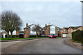
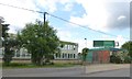
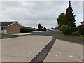
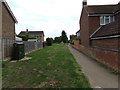
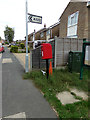
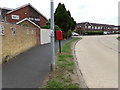
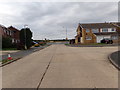

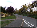
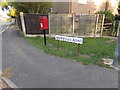
28 photos from this area
Area Information
Key information about the CO6 1NE including its size, population, and administrative classification.
- Area Type
- Postcode
- Area Size
- 1.3 hectares
- Population
- 1215
- Population Density
- 479 people/km²
House Prices in CO6 1NE
25
Properties
£242,077
Average Sold Price
£56,000
Lowest Price
£477,500
Highest Price
Showing 25 properties
| Address | Type | Beds | Baths | Last Sale Price | Last Sale Date | |
|---|---|---|---|---|---|---|
| 49 Godmans Lane, Marks Tey, CO6 1NE | Detached | 4 | 1 | £400,000 | Jul 2025 | |
| 52 Godmans Lane, Marks Tey, CO6 1NE | house | - | - | £477,500 | Feb 2022 | |
| 38 Godmans Lane, Marks Tey, CO6 1NE | Semi-detached | 3 | 1 | £295,000 | Jul 2020 | |
| 58 Godmans Lane, Marks Tey, CO6 1NE | Bungalow | - | - | £280,500 | May 2020 | |
| 40 Godmans Lane, Marks Tey, CO6 1NE | Semi-detached | 4 | - | £318,000 | Feb 2020 | |
| 50 Godmans Lane, Marks Tey, CO6 1NE | Detached | 4 | 1 | £325,000 | Oct 2019 | |
| 60 Godmans Lane, Marks Tey, CO6 1NE | Detached | 4 | 2 | £250,000 | Nov 2013 | |
| 42 Godmans Lane, Marks Tey, CO6 1NE | Semi-detached | 3 | - | £179,995 | Dec 2012 | |
| 59 Godmans Lane, Marks Tey, CO6 1NE | Detached | - | - | £240,000 | Jun 2007 | |
| 43 Godmans Lane, Marks Tey, CO6 1NE | Detached | - | - | £181,000 | Dec 2002 |
Page 1 of 3
Energy Efficiency in CO6 1NE
Amenities
Schools
| Rank | School | Type | Entry gender | Ages |
|---|
Explore more schools in this area
Go to Schools tabDemographics
Household Size
Two person
most common
Accommodation Type
Houses
most common
Tenure
92
majority
Ethnic Group
White
most common
Religion
N/A
most common
Household Composition
N/A
most common
Age
47
median
Adults (30-64 years)
most common
Household Deprivation
N/A
with no deprivation
NS-SEC
39
in Lower managerial occupations
Explore more demographic insights in this area
Go to Demographics tabPlanning
Planning Constraints
- Flood RiskPremium
- Ramsar Wetland SitesPremium
- Area of Outstanding Natural BeautyPremium
- Protected Nature ReservePremium
- Protected WoodlandPremium